You are here: Home > Network List > IW - Intermountain West Stations List
> Station MOOW Moose Ponds, Wyoming, USA > Earthquake Result Viewer
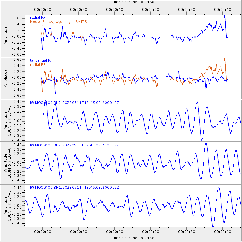
MOOW Moose Ponds, Wyoming, USA - Earthquake Result Viewer
*The percent match for this event was below the threshold and hence no stack was calculated.
| Earthquake location: |
Southwestern Ryukyu Isl., Japan |
| Earthquake latitude/longitude: |
24.2/125.3 |
| Earthquake time(UTC): |
2023/05/11 (131) 13:33:14 GMT |
| Earthquake Depth: |
25 km |
| Earthquake Magnitude: |
5.9 mww |
| Earthquake Catalog/Contributor: |
NEIC PDE/us |
|
| Network: |
IW Intermountain West |
| Station: |
MOOW Moose Ponds, Wyoming, USA |
| Lat/Lon: |
43.75 N/110.74 W |
| Elevation: |
2128 m |
|
| Distance: |
95.1 deg |
| Az: |
37.116 deg |
| Baz: |
310.511 deg |
| Ray Param: |
$rayparam |
*The percent match for this event was below the threshold and hence was not used in the summary stack. |
|
| Radial Match: |
43.674664 % |
| Radial Bump: |
400 |
| Transverse Match: |
65.57823 % |
| Transverse Bump: |
400 |
| SOD ConfigId: |
30536071 |
| Insert Time: |
2023-05-25 13:46:44.796 +0000 |
| GWidth: |
2.5 |
| Max Bumps: |
400 |
| Tol: |
0.001 |
|
Signal To Noise
| Channel | StoN | STA | LTA |
| IW:MOOW:00:BHZ:20230511T13:46:03.200012Z | 0.8191737 | 1.413637E-7 | 1.7256865E-7 |
| IW:MOOW:00:BH1:20230511T13:46:03.200012Z | 2.1167967 | 1.8103059E-7 | 8.552101E-8 |
| IW:MOOW:00:BH2:20230511T13:46:03.200012Z | 1.047228 | 1.6115636E-7 | 1.5388852E-7 |
| Arrivals |
| Ps | |
| PpPs | |
| PsPs/PpSs | |


