You are here: Home > Network List > TA - USArray Transportable Network (new EarthScope stations) Stations List
> Station H27A Howes, SD, USA > Earthquake Result Viewer
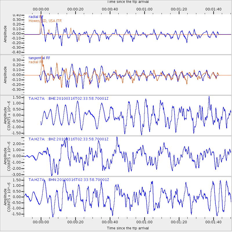
H27A Howes, SD, USA - Earthquake Result Viewer
*The percent match for this event was below the threshold and hence no stack was calculated.
| Earthquake location: |
Near Coast Of Central Chile |
| Earthquake latitude/longitude: |
-36.2/-73.3 |
| Earthquake time(UTC): |
2010/03/16 (075) 02:21:57 GMT |
| Earthquake Depth: |
18 km |
| Earthquake Magnitude: |
6.0 MB, 6.7 MS, 6.7 MW, 6.6 MW |
| Earthquake Catalog/Contributor: |
WHDF/NEIC |
|
| Network: |
TA USArray Transportable Network (new EarthScope stations) |
| Station: |
H27A Howes, SD, USA |
| Lat/Lon: |
44.63 N/102.08 W |
| Elevation: |
748 m |
|
| Distance: |
84.6 deg |
| Az: |
339.775 deg |
| Baz: |
156.948 deg |
| Ray Param: |
$rayparam |
*The percent match for this event was below the threshold and hence was not used in the summary stack. |
|
| Radial Match: |
68.78943 % |
| Radial Bump: |
400 |
| Transverse Match: |
60.186558 % |
| Transverse Bump: |
400 |
| SOD ConfigId: |
308276 |
| Insert Time: |
2010-06-22 20:27:39.736 +0000 |
| GWidth: |
2.5 |
| Max Bumps: |
400 |
| Tol: |
0.001 |
|
Signal To Noise
| Channel | StoN | STA | LTA |
| TA:H27A: :BHZ:20100316T02:33:58.70001Z | 4.1633663 | 7.510837E-7 | 1.8040299E-7 |
| TA:H27A: :BHN:20100316T02:33:58.70001Z | 1.9251343 | 7.66426E-7 | 3.981156E-7 |
| TA:H27A: :BHE:20100316T02:33:58.70001Z | 0.96641535 | 5.535621E-7 | 5.727993E-7 |
| Arrivals |
| Ps | |
| PpPs | |
| PsPs/PpSs | |


