You are here: Home > Network List > US - United States National Seismic Network Stations List
> Station AMTX Amarillo, Texas, USA > Earthquake Result Viewer
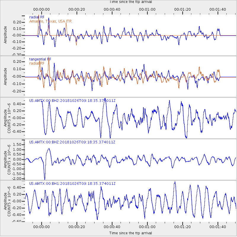
AMTX Amarillo, Texas, USA - Earthquake Result Viewer
*The percent match for this event was below the threshold and hence no stack was calculated.
| Earthquake location: |
Mariana Islands Region |
| Earthquake latitude/longitude: |
17.4/147.9 |
| Earthquake time(UTC): |
2018/10/26 (299) 09:05:39 GMT |
| Earthquake Depth: |
10 km |
| Earthquake Magnitude: |
5.7 mww |
| Earthquake Catalog/Contributor: |
NEIC PDE/us |
|
| Network: |
US United States National Seismic Network |
| Station: |
AMTX Amarillo, Texas, USA |
| Lat/Lon: |
34.53 N/101.41 W |
| Elevation: |
1010 m |
|
| Distance: |
96.4 deg |
| Az: |
50.992 deg |
| Baz: |
296.002 deg |
| Ray Param: |
$rayparam |
*The percent match for this event was below the threshold and hence was not used in the summary stack. |
|
| Radial Match: |
64.55045 % |
| Radial Bump: |
400 |
| Transverse Match: |
59.489212 % |
| Transverse Bump: |
400 |
| SOD ConfigId: |
3103472 |
| Insert Time: |
2018-11-09 17:12:17.102 +0000 |
| GWidth: |
2.5 |
| Max Bumps: |
400 |
| Tol: |
0.001 |
|
Signal To Noise
| Channel | StoN | STA | LTA |
| US:AMTX:00:BHZ:20181026T09:18:35.374011Z | 5.6257567 | 9.166636E-7 | 1.629405E-7 |
| US:AMTX:00:BH1:20181026T09:18:35.374011Z | 1.3400478 | 1.9125713E-7 | 1.427241E-7 |
| US:AMTX:00:BH2:20181026T09:18:35.374011Z | 1.4611723 | 3.2865145E-7 | 2.2492311E-7 |
| Arrivals |
| Ps | |
| PpPs | |
| PsPs/PpSs | |


