You are here: Home > Network List > US - United States National Seismic Network Stations List
> Station ELK Elko, Nevada, USA > Earthquake Result Viewer
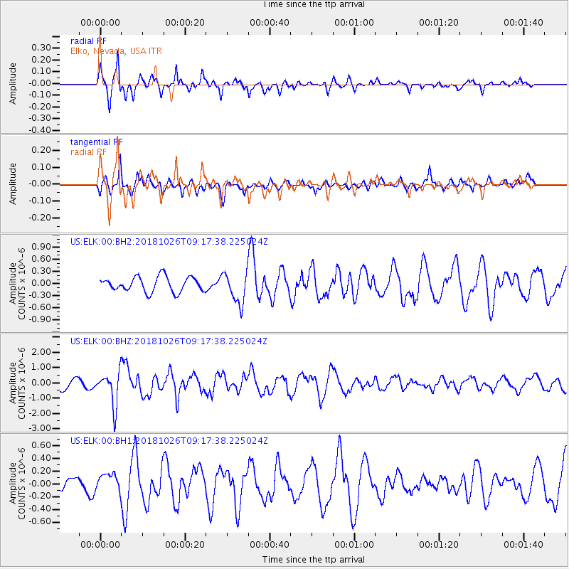
ELK Elko, Nevada, USA - Earthquake Result Viewer
*The percent match for this event was below the threshold and hence no stack was calculated.
| Earthquake location: |
Mariana Islands Region |
| Earthquake latitude/longitude: |
17.4/147.9 |
| Earthquake time(UTC): |
2018/10/26 (299) 09:05:39 GMT |
| Earthquake Depth: |
10 km |
| Earthquake Magnitude: |
5.7 mww |
| Earthquake Catalog/Contributor: |
NEIC PDE/us |
|
| Network: |
US United States National Seismic Network |
| Station: |
ELK Elko, Nevada, USA |
| Lat/Lon: |
40.74 N/115.24 W |
| Elevation: |
2210 m |
|
| Distance: |
83.9 deg |
| Az: |
49.34 deg |
| Baz: |
287.558 deg |
| Ray Param: |
$rayparam |
*The percent match for this event was below the threshold and hence was not used in the summary stack. |
|
| Radial Match: |
86.487976 % |
| Radial Bump: |
330 |
| Transverse Match: |
69.03799 % |
| Transverse Bump: |
400 |
| SOD ConfigId: |
3103472 |
| Insert Time: |
2018-11-09 17:12:32.570 +0000 |
| GWidth: |
2.5 |
| Max Bumps: |
400 |
| Tol: |
0.001 |
|
Signal To Noise
| Channel | StoN | STA | LTA |
| US:ELK:00:BHZ:20181026T09:17:38.225024Z | 3.3544912 | 1.1116473E-6 | 3.3139074E-7 |
| US:ELK:00:BH1:20181026T09:17:38.225024Z | 0.96366036 | 1.2836409E-7 | 1.3320471E-7 |
| US:ELK:00:BH2:20181026T09:17:38.225024Z | 2.146914 | 3.9164306E-7 | 1.824214E-7 |
| Arrivals |
| Ps | |
| PpPs | |
| PsPs/PpSs | |


