You are here: Home > Network List > US - United States National Seismic Network Stations List
> Station EGMT Eagleton, Montana, USA > Earthquake Result Viewer
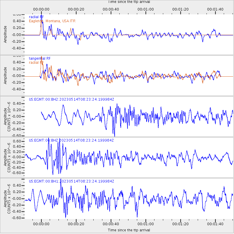
EGMT Eagleton, Montana, USA - Earthquake Result Viewer
*The percent match for this event was below the threshold and hence no stack was calculated.
| Earthquake location: |
Southeast Of Honshu, Japan |
| Earthquake latitude/longitude: |
33.4/139.4 |
| Earthquake time(UTC): |
2023/05/14 (134) 08:11:57 GMT |
| Earthquake Depth: |
14 km |
| Earthquake Magnitude: |
5.5 mww |
| Earthquake Catalog/Contributor: |
NEIC PDE/us |
|
| Network: |
US United States National Seismic Network |
| Station: |
EGMT Eagleton, Montana, USA |
| Lat/Lon: |
48.02 N/109.75 W |
| Elevation: |
1055 m |
|
| Distance: |
78.1 deg |
| Az: |
39.876 deg |
| Baz: |
306.967 deg |
| Ray Param: |
$rayparam |
*The percent match for this event was below the threshold and hence was not used in the summary stack. |
|
| Radial Match: |
62.162994 % |
| Radial Bump: |
400 |
| Transverse Match: |
48.327606 % |
| Transverse Bump: |
400 |
| SOD ConfigId: |
30536071 |
| Insert Time: |
2023-05-28 08:35:31.492 +0000 |
| GWidth: |
2.5 |
| Max Bumps: |
400 |
| Tol: |
0.001 |
|
Signal To Noise
| Channel | StoN | STA | LTA |
| US:EGMT:00:BHZ:20230514T08:23:24.199984Z | 2.419113 | 2.406336E-7 | 9.947183E-8 |
| US:EGMT:00:BH1:20230514T08:23:24.199984Z | 1.4791303 | 1.3351155E-7 | 9.026355E-8 |
| US:EGMT:00:BH2:20230514T08:23:24.199984Z | 0.453706 | 6.624677E-8 | 1.4601254E-7 |
| Arrivals |
| Ps | |
| PpPs | |
| PsPs/PpSs | |


