You are here: Home > Network List > US - United States National Seismic Network Stations List
> Station WUAZ Wupatki, Arizona, USA > Earthquake Result Viewer
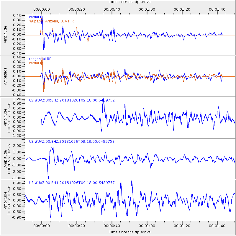
WUAZ Wupatki, Arizona, USA - Earthquake Result Viewer
*The percent match for this event was below the threshold and hence no stack was calculated.
| Earthquake location: |
Mariana Islands Region |
| Earthquake latitude/longitude: |
17.4/147.9 |
| Earthquake time(UTC): |
2018/10/26 (299) 09:05:39 GMT |
| Earthquake Depth: |
10 km |
| Earthquake Magnitude: |
5.7 mww |
| Earthquake Catalog/Contributor: |
NEIC PDE/us |
|
| Network: |
US United States National Seismic Network |
| Station: |
WUAZ Wupatki, Arizona, USA |
| Lat/Lon: |
35.52 N/111.37 W |
| Elevation: |
1592 m |
|
| Distance: |
88.5 deg |
| Az: |
53.297 deg |
| Baz: |
290.2 deg |
| Ray Param: |
$rayparam |
*The percent match for this event was below the threshold and hence was not used in the summary stack. |
|
| Radial Match: |
78.10375 % |
| Radial Bump: |
400 |
| Transverse Match: |
71.04661 % |
| Transverse Bump: |
400 |
| SOD ConfigId: |
3103472 |
| Insert Time: |
2018-11-09 17:12:57.121 +0000 |
| GWidth: |
2.5 |
| Max Bumps: |
400 |
| Tol: |
0.001 |
|
Signal To Noise
| Channel | StoN | STA | LTA |
| US:WUAZ:00:BHZ:20181026T09:18:00.648975Z | 7.035321 | 9.964456E-7 | 1.4163469E-7 |
| US:WUAZ:00:BH1:20181026T09:18:00.648975Z | 1.2046505 | 1.627847E-7 | 1.3513022E-7 |
| US:WUAZ:00:BH2:20181026T09:18:00.648975Z | 1.4811485 | 3.3043207E-7 | 2.2309179E-7 |
| Arrivals |
| Ps | |
| PpPs | |
| PsPs/PpSs | |


