You are here: Home > Network List > US - United States National Seismic Network Stations List
> Station AGMN Agassiz National Wildlife Refuge, Minnesota, USA > Earthquake Result Viewer
AGMN Agassiz National Wildlife Refuge, Minnesota, USA - Earthquake Result Viewer
*The percent match for this event was below the threshold and hence no stack was calculated.
| Earthquake location: |
Southeast Of Honshu, Japan |
| Earthquake latitude/longitude: |
33.3/139.3 |
| Earthquake time(UTC): |
2023/05/14 (134) 08:21:41 GMT |
| Earthquake Depth: |
5.9 km |
| Earthquake Magnitude: |
5.8 Mww |
| Earthquake Catalog/Contributor: |
NEIC PDE/us |
|
| Network: |
US United States National Seismic Network |
| Station: |
AGMN Agassiz National Wildlife Refuge, Minnesota, USA |
| Lat/Lon: |
48.30 N/95.86 W |
| Elevation: |
351 m |
|
| Distance: |
84.9 deg |
| Az: |
33.402 deg |
| Baz: |
316.362 deg |
| Ray Param: |
$rayparam |
*The percent match for this event was below the threshold and hence was not used in the summary stack. |
|
| Radial Match: |
44.270542 % |
| Radial Bump: |
400 |
| Transverse Match: |
47.734623 % |
| Transverse Bump: |
400 |
| SOD ConfigId: |
30536071 |
| Insert Time: |
2023-05-28 09:03:55.367 +0000 |
| GWidth: |
2.5 |
| Max Bumps: |
400 |
| Tol: |
0.001 |
|
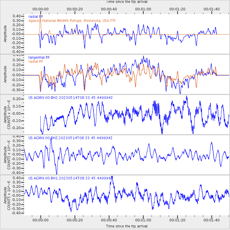
Signal To Noise
| Channel | StoN | STA | LTA |
| US:AGMN:00:BHZ:20230514T08:33:45.449994Z | 1.2432436 | 1.3230418E-7 | 1.06418554E-7 |
| US:AGMN:00:BH1:20230514T08:33:45.449994Z | 1.2619363 | 2.0508593E-7 | 1.6251686E-7 |
| US:AGMN:00:BH2:20230514T08:33:45.449994Z | 1.5803857 | 1.4857417E-7 | 9.401134E-8 |
| Arrivals |
| Ps | |
| PpPs | |
| PsPs/PpSs | |


