You are here: Home > Network List > UW - Pacific Northwest Regional Seismic Network Stations List
> Station MRBL Marblemount, WA, USA > Earthquake Result Viewer
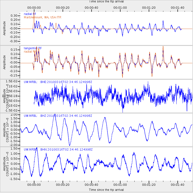
MRBL Marblemount, WA, USA - Earthquake Result Viewer
*The percent match for this event was below the threshold and hence no stack was calculated.
| Earthquake location: |
Near Coast Of Central Chile |
| Earthquake latitude/longitude: |
-36.2/-73.3 |
| Earthquake time(UTC): |
2010/03/16 (075) 02:21:57 GMT |
| Earthquake Depth: |
18 km |
| Earthquake Magnitude: |
6.0 MB, 6.7 MS, 6.7 MW, 6.6 MW |
| Earthquake Catalog/Contributor: |
WHDF/NEIC |
|
| Network: |
UW Pacific Northwest Regional Seismic Network |
| Station: |
MRBL Marblemount, WA, USA |
| Lat/Lon: |
48.52 N/121.48 W |
| Elevation: |
75 m |
|
| Distance: |
94.7 deg |
| Az: |
330.165 deg |
| Baz: |
142.764 deg |
| Ray Param: |
$rayparam |
*The percent match for this event was below the threshold and hence was not used in the summary stack. |
|
| Radial Match: |
52.722996 % |
| Radial Bump: |
400 |
| Transverse Match: |
52.76295 % |
| Transverse Bump: |
400 |
| SOD ConfigId: |
308276 |
| Insert Time: |
2010-06-22 20:42:07.407 +0000 |
| GWidth: |
2.5 |
| Max Bumps: |
400 |
| Tol: |
0.001 |
|
Signal To Noise
| Channel | StoN | STA | LTA |
| UW:MRBL: :BHZ:20100316T02:34:46.124998Z | 0.9116857 | 3.7621163E-7 | 4.1265497E-7 |
| UW:MRBL: :BHN:20100316T02:34:46.124998Z | 2.1824548 | 9.789347E-7 | 4.4854752E-7 |
| UW:MRBL: :BHE:20100316T02:34:46.124998Z | 1.0865926 | 4.8668225E-9 | 4.4789763E-9 |
| Arrivals |
| Ps | |
| PpPs | |
| PsPs/PpSs | |


