You are here: Home > Network List > US - United States National Seismic Network Stations List
> Station DGMT Dagmar, Montana, USA > Earthquake Result Viewer
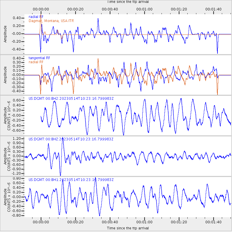
DGMT Dagmar, Montana, USA - Earthquake Result Viewer
*The percent match for this event was below the threshold and hence no stack was calculated.
| Earthquake location: |
Southeast Of Honshu, Japan |
| Earthquake latitude/longitude: |
33.4/139.3 |
| Earthquake time(UTC): |
2023/05/14 (134) 10:11:35 GMT |
| Earthquake Depth: |
14 km |
| Earthquake Magnitude: |
5.6 mww |
| Earthquake Catalog/Contributor: |
NEIC PDE/us |
|
| Network: |
US United States National Seismic Network |
| Station: |
DGMT Dagmar, Montana, USA |
| Lat/Lon: |
48.47 N/104.20 W |
| Elevation: |
646 m |
|
| Distance: |
80.7 deg |
| Az: |
37.119 deg |
| Baz: |
310.669 deg |
| Ray Param: |
$rayparam |
*The percent match for this event was below the threshold and hence was not used in the summary stack. |
|
| Radial Match: |
44.813705 % |
| Radial Bump: |
400 |
| Transverse Match: |
59.203045 % |
| Transverse Bump: |
373 |
| SOD ConfigId: |
30536071 |
| Insert Time: |
2023-05-28 10:36:22.710 +0000 |
| GWidth: |
2.5 |
| Max Bumps: |
400 |
| Tol: |
0.001 |
|
Signal To Noise
| Channel | StoN | STA | LTA |
| US:DGMT:00:BHZ:20230514T10:23:16.799983Z | 1.9863824 | 3.0044623E-7 | 1.5125296E-7 |
| US:DGMT:00:BH1:20230514T10:23:16.799983Z | 0.49786806 | 1.0958936E-7 | 2.2011727E-7 |
| US:DGMT:00:BH2:20230514T10:23:16.799983Z | 1.0929335 | 3.115021E-7 | 2.850147E-7 |
| Arrivals |
| Ps | |
| PpPs | |
| PsPs/PpSs | |


