You are here: Home > Network List > TA - USArray Transportable Network (new EarthScope stations) Stations List
> Station A21A Bergtoll Ranch, Theony, MT, USA > Earthquake Result Viewer
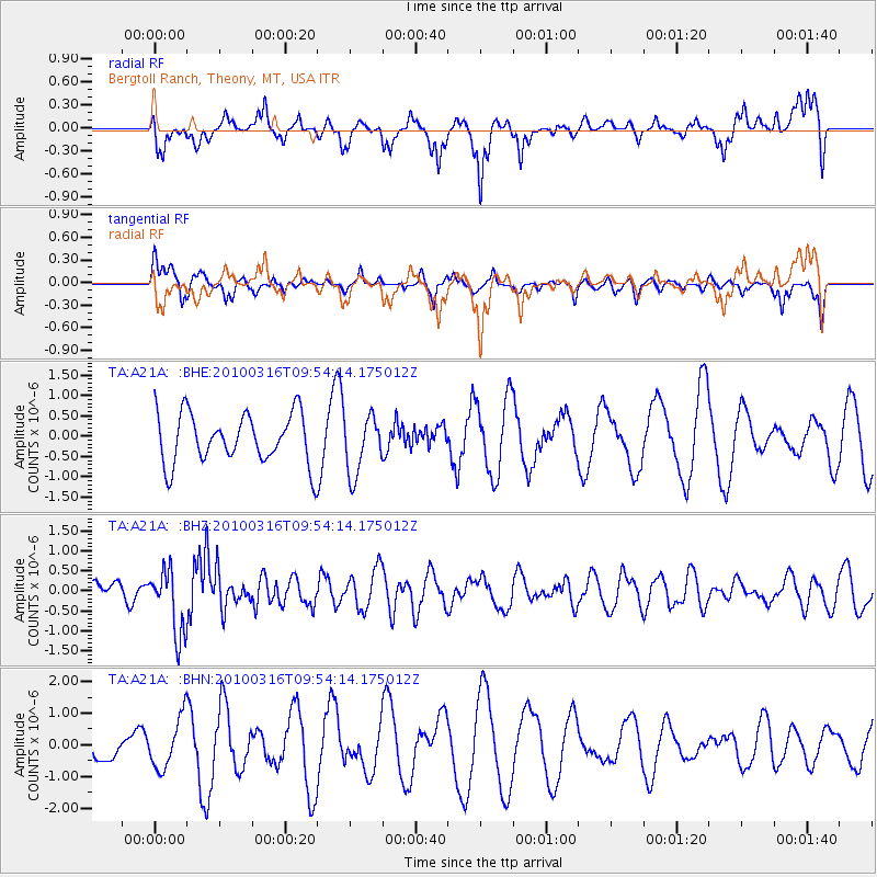
A21A Bergtoll Ranch, Theony, MT, USA - Earthquake Result Viewer
*The percent match for this event was below the threshold and hence no stack was calculated.
| Earthquake location: |
Sakhalin, Russia |
| Earthquake latitude/longitude: |
52.1/142.2 |
| Earthquake time(UTC): |
2010/03/16 (075) 09:44:17 GMT |
| Earthquake Depth: |
24 km |
| Earthquake Magnitude: |
5.6 MB, 5.5 MS, 5.8 MW, 5.8 MW |
| Earthquake Catalog/Contributor: |
WHDF/NEIC |
|
| Network: |
TA USArray Transportable Network (new EarthScope stations) |
| Station: |
A21A Bergtoll Ranch, Theony, MT, USA |
| Lat/Lon: |
48.99 N/106.93 W |
| Elevation: |
779 m |
|
| Distance: |
63.4 deg |
| Az: |
43.5 deg |
| Baz: |
319.892 deg |
| Ray Param: |
$rayparam |
*The percent match for this event was below the threshold and hence was not used in the summary stack. |
|
| Radial Match: |
58.893147 % |
| Radial Bump: |
400 |
| Transverse Match: |
53.449493 % |
| Transverse Bump: |
400 |
| SOD ConfigId: |
308276 |
| Insert Time: |
2010-06-22 20:56:54.640 +0000 |
| GWidth: |
2.5 |
| Max Bumps: |
400 |
| Tol: |
0.001 |
|
Signal To Noise
| Channel | StoN | STA | LTA |
| TA:A21A: :BHZ:20100316T09:54:14.175012Z | 1.9044969 | 8.103284E-7 | 4.254816E-7 |
| TA:A21A: :BHN:20100316T09:54:14.175012Z | 1.5128261 | 8.037944E-7 | 5.3131976E-7 |
| TA:A21A: :BHE:20100316T09:54:14.175012Z | 1.1631743 | 7.135746E-7 | 6.134718E-7 |
| Arrivals |
| Ps | |
| PpPs | |
| PsPs/PpSs | |


