You are here: Home > Network List > TA - USArray Transportable Network (new EarthScope stations) Stations List
> Station 431A Sonora, TX, USA > Earthquake Result Viewer
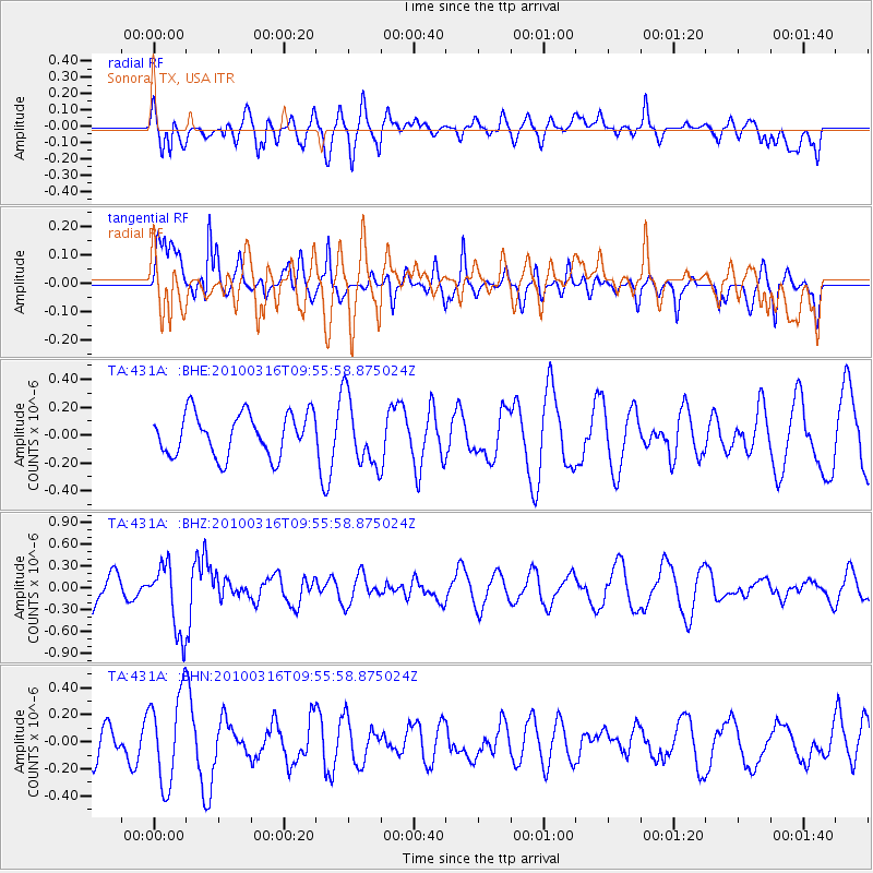
431A Sonora, TX, USA - Earthquake Result Viewer
*The percent match for this event was below the threshold and hence no stack was calculated.
| Earthquake location: |
Sakhalin, Russia |
| Earthquake latitude/longitude: |
52.1/142.2 |
| Earthquake time(UTC): |
2010/03/16 (075) 09:44:17 GMT |
| Earthquake Depth: |
24 km |
| Earthquake Magnitude: |
5.6 MB, 5.5 MS, 5.8 MW, 5.8 MW |
| Earthquake Catalog/Contributor: |
WHDF/NEIC |
|
| Network: |
TA USArray Transportable Network (new EarthScope stations) |
| Station: |
431A Sonora, TX, USA |
| Lat/Lon: |
30.68 N/100.61 W |
| Elevation: |
700 m |
|
| Distance: |
81.0 deg |
| Az: |
50.894 deg |
| Baz: |
326.271 deg |
| Ray Param: |
$rayparam |
*The percent match for this event was below the threshold and hence was not used in the summary stack. |
|
| Radial Match: |
48.40488 % |
| Radial Bump: |
400 |
| Transverse Match: |
57.21155 % |
| Transverse Bump: |
368 |
| SOD ConfigId: |
308276 |
| Insert Time: |
2010-06-22 21:00:04.551 +0000 |
| GWidth: |
2.5 |
| Max Bumps: |
400 |
| Tol: |
0.001 |
|
Signal To Noise
| Channel | StoN | STA | LTA |
| TA:431A: :BHZ:20100316T09:55:58.875024Z | 2.4608219 | 4.685089E-7 | 1.9038715E-7 |
| TA:431A: :BHN:20100316T09:55:58.875024Z | 1.685298 | 3.3235264E-7 | 1.9720704E-7 |
| TA:431A: :BHE:20100316T09:55:58.875024Z | 1.6197766 | 2.4515796E-7 | 1.5135295E-7 |
| Arrivals |
| Ps | |
| PpPs | |
| PsPs/PpSs | |


