You are here: Home > Network List > IW - Intermountain West Stations List
> Station PLID Pearl Lake, Idaho, USA > Earthquake Result Viewer
PLID Pearl Lake, Idaho, USA - Earthquake Result Viewer
*The percent match for this event was below the threshold and hence no stack was calculated.
| Earthquake location: |
Off Coast Of Central America |
| Earthquake latitude/longitude: |
12.9/-90.4 |
| Earthquake time(UTC): |
2018/10/28 (301) 22:23:54 GMT |
| Earthquake Depth: |
25 km |
| Earthquake Magnitude: |
6.1 Mww |
| Earthquake Catalog/Contributor: |
NEIC PDE/us |
|
| Network: |
IW Intermountain West |
| Station: |
PLID Pearl Lake, Idaho, USA |
| Lat/Lon: |
45.09 N/116.00 W |
| Elevation: |
2164 m |
|
| Distance: |
38.7 deg |
| Az: |
330.705 deg |
| Baz: |
137.672 deg |
| Ray Param: |
$rayparam |
*The percent match for this event was below the threshold and hence was not used in the summary stack. |
|
| Radial Match: |
71.810616 % |
| Radial Bump: |
363 |
| Transverse Match: |
48.93183 % |
| Transverse Bump: |
400 |
| SOD ConfigId: |
3103472 |
| Insert Time: |
2018-11-11 22:33:46.000 +0000 |
| GWidth: |
2.5 |
| Max Bumps: |
400 |
| Tol: |
0.001 |
|
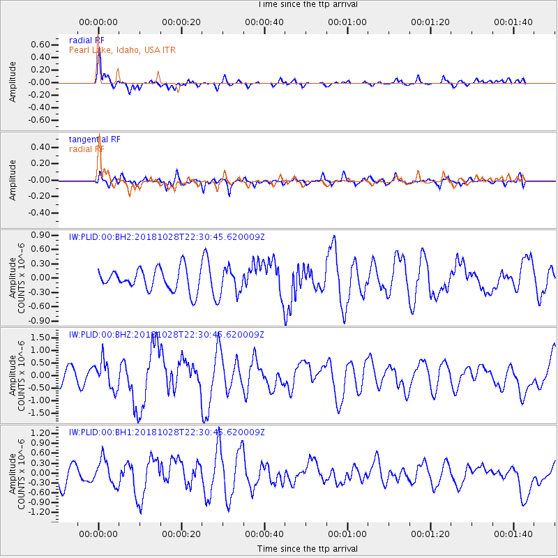
Signal To Noise
| Channel | StoN | STA | LTA |
| IW:PLID:00:BHZ:20181028T22:30:45.620009Z | 2.3729553 | 5.6243476E-7 | 2.370187E-7 |
| IW:PLID:00:BH1:20181028T22:30:45.620009Z | 1.3532931 | 3.9158104E-7 | 2.893542E-7 |
| IW:PLID:00:BH2:20181028T22:30:45.620009Z | 1.1508666 | 2.6105425E-7 | 2.2683275E-7 |
| Arrivals |
| Ps | |
| PpPs | |
| PsPs/PpSs | |


