You are here: Home > Network List > US - United States National Seismic Network Stations List
> Station AGMN Agassiz National Wildlife Refuge, Minnesota, USA > Earthquake Result Viewer
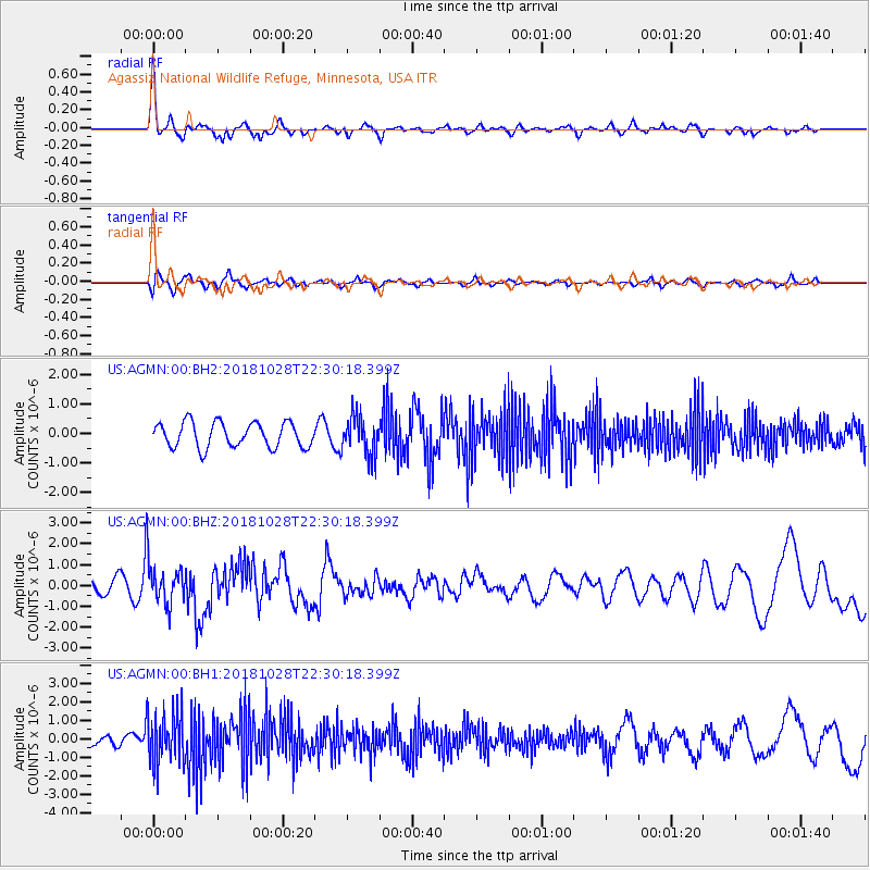
AGMN Agassiz National Wildlife Refuge, Minnesota, USA - Earthquake Result Viewer
*The percent match for this event was below the threshold and hence no stack was calculated.
| Earthquake location: |
Off Coast Of Central America |
| Earthquake latitude/longitude: |
12.9/-90.4 |
| Earthquake time(UTC): |
2018/10/28 (301) 22:23:54 GMT |
| Earthquake Depth: |
25 km |
| Earthquake Magnitude: |
6.1 Mww |
| Earthquake Catalog/Contributor: |
NEIC PDE/us |
|
| Network: |
US United States National Seismic Network |
| Station: |
AGMN Agassiz National Wildlife Refuge, Minnesota, USA |
| Lat/Lon: |
48.30 N/95.86 W |
| Elevation: |
351 m |
|
| Distance: |
35.5 deg |
| Az: |
353.704 deg |
| Baz: |
170.787 deg |
| Ray Param: |
$rayparam |
*The percent match for this event was below the threshold and hence was not used in the summary stack. |
|
| Radial Match: |
66.39088 % |
| Radial Bump: |
334 |
| Transverse Match: |
61.01117 % |
| Transverse Bump: |
400 |
| SOD ConfigId: |
3103472 |
| Insert Time: |
2018-11-11 22:34:21.116 +0000 |
| GWidth: |
2.5 |
| Max Bumps: |
400 |
| Tol: |
0.001 |
|
Signal To Noise
| Channel | StoN | STA | LTA |
| US:AGMN:00:BHZ:20181028T22:30:18.399Z | 3.096355 | 9.956598E-7 | 3.2155867E-7 |
| US:AGMN:00:BH1:20181028T22:30:18.399Z | 3.6934667 | 1.4038216E-6 | 3.8008238E-7 |
| US:AGMN:00:BH2:20181028T22:30:18.399Z | 1.5672354 | 6.600436E-7 | 4.2115155E-7 |
| Arrivals |
| Ps | |
| PpPs | |
| PsPs/PpSs | |


