You are here: Home > Network List > US - United States National Seismic Network Stations List
> Station MSO Missoula, Montana, USA > Earthquake Result Viewer
MSO Missoula, Montana, USA - Earthquake Result Viewer
*The percent match for this event was below the threshold and hence no stack was calculated.
| Earthquake location: |
Off Coast Of Central America |
| Earthquake latitude/longitude: |
12.9/-90.4 |
| Earthquake time(UTC): |
2018/10/28 (301) 22:23:54 GMT |
| Earthquake Depth: |
25 km |
| Earthquake Magnitude: |
6.1 Mww |
| Earthquake Catalog/Contributor: |
NEIC PDE/us |
|
| Network: |
US United States National Seismic Network |
| Station: |
MSO Missoula, Montana, USA |
| Lat/Lon: |
46.83 N/113.94 W |
| Elevation: |
1264 m |
|
| Distance: |
39.2 deg |
| Az: |
334.24 deg |
| Baz: |
141.897 deg |
| Ray Param: |
$rayparam |
*The percent match for this event was below the threshold and hence was not used in the summary stack. |
|
| Radial Match: |
68.56632 % |
| Radial Bump: |
392 |
| Transverse Match: |
45.745262 % |
| Transverse Bump: |
400 |
| SOD ConfigId: |
3103472 |
| Insert Time: |
2018-11-11 22:34:48.171 +0000 |
| GWidth: |
2.5 |
| Max Bumps: |
400 |
| Tol: |
0.001 |
|
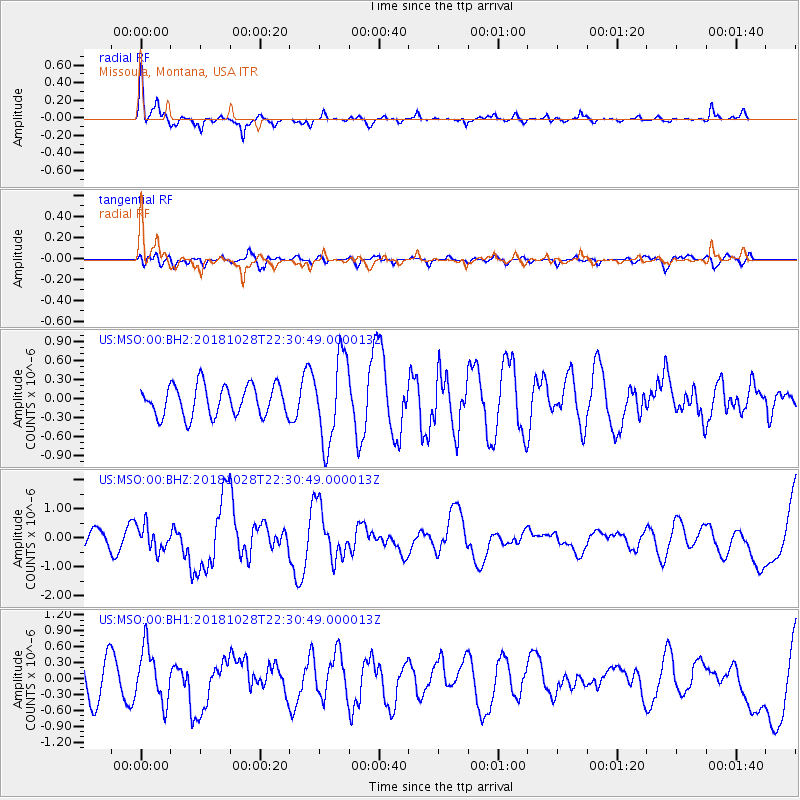
Signal To Noise
| Channel | StoN | STA | LTA |
| US:MSO:00:BHZ:20181028T22:30:49.000013Z | 1.0335779 | 4.2574987E-7 | 4.1191853E-7 |
| US:MSO:00:BH1:20181028T22:30:49.000013Z | 1.7779377 | 5.033801E-7 | 2.8312581E-7 |
| US:MSO:00:BH2:20181028T22:30:49.000013Z | 2.7641468 | 6.7014986E-7 | 2.4244366E-7 |
| Arrivals |
| Ps | |
| PpPs | |
| PsPs/PpSs | |


