
SA31 XA.SA31 - Earthquake Result Viewer
| ||||||||||||||||||
| ||||||||||||||||||
| ||||||||||||||||||
|
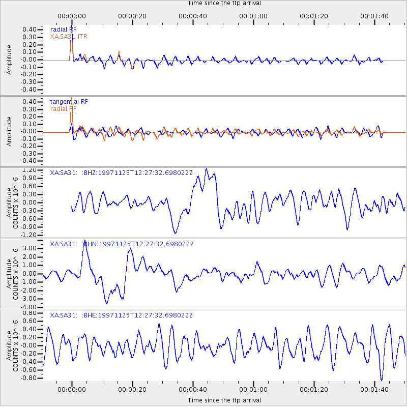
Signal To Noise
| Channel | StoN | STA | LTA |
| XA:SA31: :BHN:19971125T12:27:32.698022Z | 5.841279 | 1.7844637E-6 | 3.0549194E-7 |
| XA:SA31: :BHE:19971125T12:27:32.698022Z | 0.74070024 | 2.2542262E-7 | 3.0433716E-7 |
| XA:SA31: :BHZ:19971125T12:27:32.698022Z | 2.922582 | 5.8470334E-7 | 2.0006397E-7 |
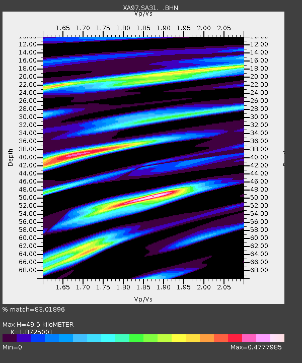
| Arrivals | |
| Ps | 6.8 SECOND |
| PpPs | 22 SECOND |
| PsPs/PpSs | 28 SECOND |

