You are here: Home > Network List > TA - USArray Transportable Network (new EarthScope stations) Stations List
> Station C22A Vida, MT, USA > Earthquake Result Viewer
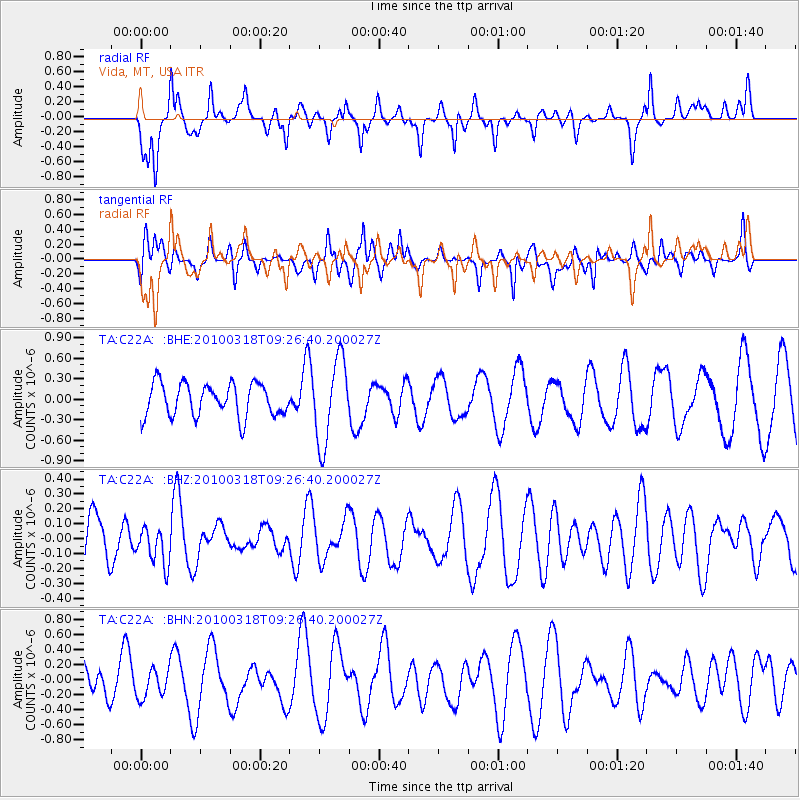
C22A Vida, MT, USA - Earthquake Result Viewer
*The percent match for this event was below the threshold and hence no stack was calculated.
| Earthquake location: |
South Of Fiji Islands |
| Earthquake latitude/longitude: |
-23.3/-177.2 |
| Earthquake time(UTC): |
2010/03/18 (077) 09:14:05 GMT |
| Earthquake Depth: |
158 km |
| Earthquake Magnitude: |
5.6 MW, 5.2 MB, 5.5 MW |
| Earthquake Catalog/Contributor: |
WHDF/NEIC |
|
| Network: |
TA USArray Transportable Network (new EarthScope stations) |
| Station: |
C22A Vida, MT, USA |
| Lat/Lon: |
47.75 N/105.88 W |
| Elevation: |
745 m |
|
| Distance: |
95.2 deg |
| Az: |
39.936 deg |
| Baz: |
240.972 deg |
| Ray Param: |
$rayparam |
*The percent match for this event was below the threshold and hence was not used in the summary stack. |
|
| Radial Match: |
67.9125 % |
| Radial Bump: |
400 |
| Transverse Match: |
59.868294 % |
| Transverse Bump: |
400 |
| SOD ConfigId: |
308276 |
| Insert Time: |
2010-06-22 21:24:38.513 +0000 |
| GWidth: |
2.5 |
| Max Bumps: |
400 |
| Tol: |
0.001 |
|
Signal To Noise
| Channel | StoN | STA | LTA |
| TA:C22A: :BHZ:20100318T09:26:40.200027Z | 0.9526988 | 1.2914391E-7 | 1.3555587E-7 |
| TA:C22A: :BHN:20100318T09:26:40.200027Z | 0.7917362 | 1.9082663E-7 | 2.4102297E-7 |
| TA:C22A: :BHE:20100318T09:26:40.200027Z | 2.5619407 | 6.145856E-7 | 2.3989065E-7 |
| Arrivals |
| Ps | |
| PpPs | |
| PsPs/PpSs | |


