You are here: Home > Network List > WY - Yellowstone Wyoming Seismic Network Stations List
> Station YHH Holmes Hill, YNP, WY, USA > Earthquake Result Viewer
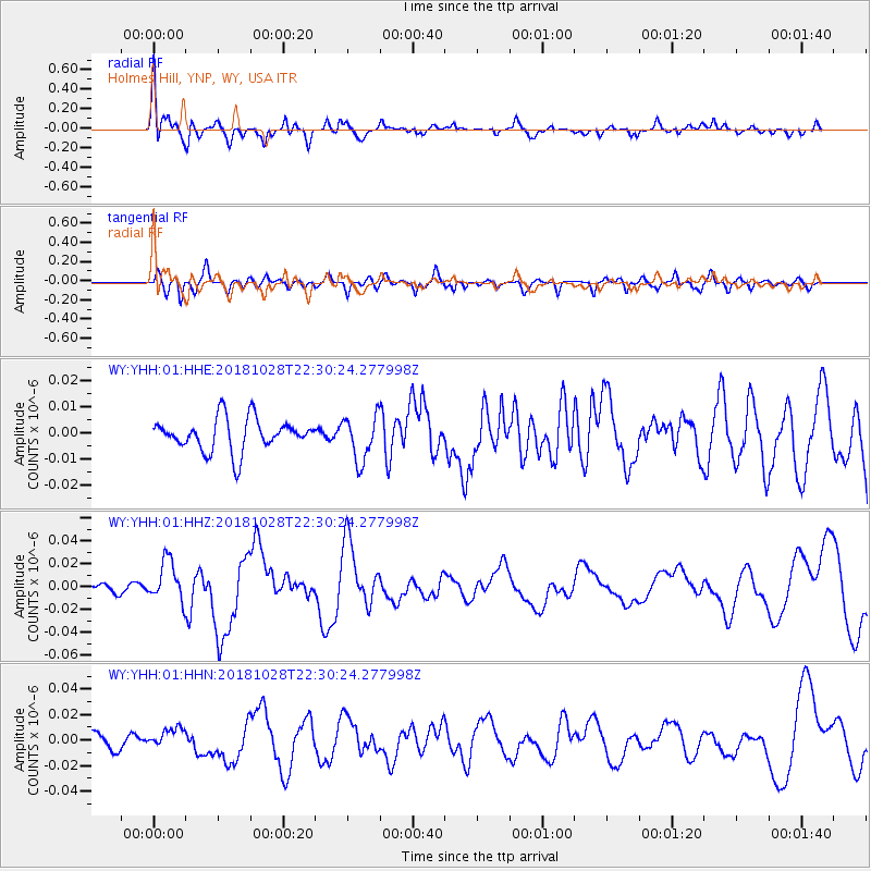
YHH Holmes Hill, YNP, WY, USA - Earthquake Result Viewer
*The percent match for this event was below the threshold and hence no stack was calculated.
| Earthquake location: |
Off Coast Of Central America |
| Earthquake latitude/longitude: |
12.9/-90.4 |
| Earthquake time(UTC): |
2018/10/28 (301) 22:23:54 GMT |
| Earthquake Depth: |
25 km |
| Earthquake Magnitude: |
6.1 Mww |
| Earthquake Catalog/Contributor: |
NEIC PDE/us |
|
| Network: |
WY Yellowstone Wyoming Seismic Network |
| Station: |
YHH Holmes Hill, YNP, WY, USA |
| Lat/Lon: |
44.79 N/110.85 W |
| Elevation: |
2717 m |
|
| Distance: |
36.2 deg |
| Az: |
335.082 deg |
| Baz: |
144.773 deg |
| Ray Param: |
$rayparam |
*The percent match for this event was below the threshold and hence was not used in the summary stack. |
|
| Radial Match: |
79.9714 % |
| Radial Bump: |
400 |
| Transverse Match: |
70.64465 % |
| Transverse Bump: |
400 |
| SOD ConfigId: |
3103472 |
| Insert Time: |
2018-11-11 22:35:59.768 +0000 |
| GWidth: |
2.5 |
| Max Bumps: |
400 |
| Tol: |
0.001 |
|
Signal To Noise
| Channel | StoN | STA | LTA |
| WY:YHH:01:HHZ:20181028T22:30:24.277998Z | 4.6418347 | 1.7748471E-8 | 3.82359E-9 |
| WY:YHH:01:HHN:20181028T22:30:24.277998Z | 1.585622 | 8.125363E-9 | 5.124401E-9 |
| WY:YHH:01:HHE:20181028T22:30:24.277998Z | 1.4027119 | 8.568755E-9 | 6.1087064E-9 |
| Arrivals |
| Ps | |
| PpPs | |
| PsPs/PpSs | |


