You are here: Home > Network List > GS - US Geological Survey Networks Stations List
> Station OK051 E0350 and S34600 Roads, Ralston, OK > Earthquake Result Viewer
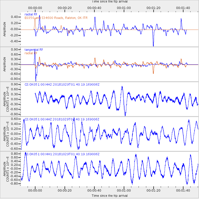
OK051 E0350 and S34600 Roads, Ralston, OK - Earthquake Result Viewer
*The percent match for this event was below the threshold and hence no stack was calculated.
| Earthquake location: |
Southeast Of Honshu, Japan |
| Earthquake latitude/longitude: |
31.6/140.2 |
| Earthquake time(UTC): |
2018/10/29 (302) 01:27:44 GMT |
| Earthquake Depth: |
94 km |
| Earthquake Magnitude: |
5.5 Mww |
| Earthquake Catalog/Contributor: |
NEIC PDE/us |
|
| Network: |
GS US Geological Survey Networks |
| Station: |
OK051 E0350 and S34600 Roads, Ralston, OK |
| Lat/Lon: |
36.51 N/96.84 W |
| Elevation: |
263 m |
|
| Distance: |
93.7 deg |
| Az: |
42.663 deg |
| Baz: |
314.128 deg |
| Ray Param: |
$rayparam |
*The percent match for this event was below the threshold and hence was not used in the summary stack. |
|
| Radial Match: |
71.50511 % |
| Radial Bump: |
382 |
| Transverse Match: |
77.8941 % |
| Transverse Bump: |
400 |
| SOD ConfigId: |
3103472 |
| Insert Time: |
2018-11-12 01:36:33.803 +0000 |
| GWidth: |
2.5 |
| Max Bumps: |
400 |
| Tol: |
0.001 |
|
Signal To Noise
| Channel | StoN | STA | LTA |
| GS:OK051:00:HHZ:20181029T01:40:19.169006Z | 0.4806149 | 1.8629025E-7 | 3.8760814E-7 |
| GS:OK051:00:HH1:20181029T01:40:19.169006Z | 0.64316636 | 2.4050962E-7 | 3.739462E-7 |
| GS:OK051:00:HH2:20181029T01:40:19.169006Z | 0.8244402 | 1.7737979E-7 | 2.151518E-7 |
| Arrivals |
| Ps | |
| PpPs | |
| PsPs/PpSs | |


