You are here: Home > Network List > AZ - ANZA Regional Network Stations List
> Station SMER AZ.SMER > Earthquake Result Viewer
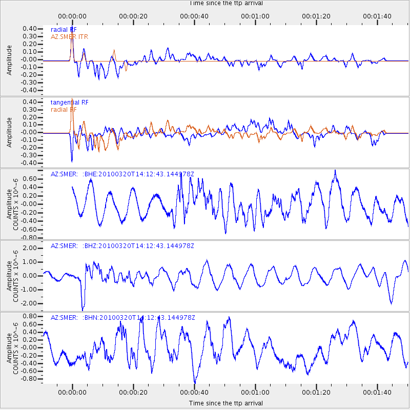
SMER AZ.SMER - Earthquake Result Viewer
*The percent match for this event was below the threshold and hence no stack was calculated.
| Earthquake location: |
New Ireland Region, P.N.G. |
| Earthquake latitude/longitude: |
-3.4/152.2 |
| Earthquake time(UTC): |
2010/03/20 (079) 14:00:49 GMT |
| Earthquake Depth: |
415 km |
| Earthquake Magnitude: |
6.0 MB, 6.6 MW, 6.5 MW |
| Earthquake Catalog/Contributor: |
WHDF/NEIC |
|
| Network: |
AZ ANZA Regional Network |
| Station: |
SMER AZ.SMER |
| Lat/Lon: |
33.46 N/117.17 W |
| Elevation: |
355 m |
|
| Distance: |
92.3 deg |
| Az: |
56.786 deg |
| Baz: |
267.528 deg |
| Ray Param: |
$rayparam |
*The percent match for this event was below the threshold and hence was not used in the summary stack. |
|
| Radial Match: |
72.066635 % |
| Radial Bump: |
400 |
| Transverse Match: |
53.771374 % |
| Transverse Bump: |
400 |
| SOD ConfigId: |
308276 |
| Insert Time: |
2010-06-22 21:34:03.605 +0000 |
| GWidth: |
2.5 |
| Max Bumps: |
400 |
| Tol: |
0.001 |
|
Signal To Noise
| Channel | StoN | STA | LTA |
| AZ:SMER: :BHZ:20100320T14:12:43.144978Z | 4.353357 | 9.952455E-7 | 2.2861563E-7 |
| AZ:SMER: :BHN:20100320T14:12:43.144978Z | 1.7791398 | 4.0022417E-7 | 2.2495377E-7 |
| AZ:SMER: :BHE:20100320T14:12:43.144978Z | 0.84157073 | 2.453428E-7 | 2.915296E-7 |
| Arrivals |
| Ps | |
| PpPs | |
| PsPs/PpSs | |


