You are here: Home > Network List > IW - Intermountain West Stations List
> Station PLID Pearl Lake, Idaho, USA > Earthquake Result Viewer
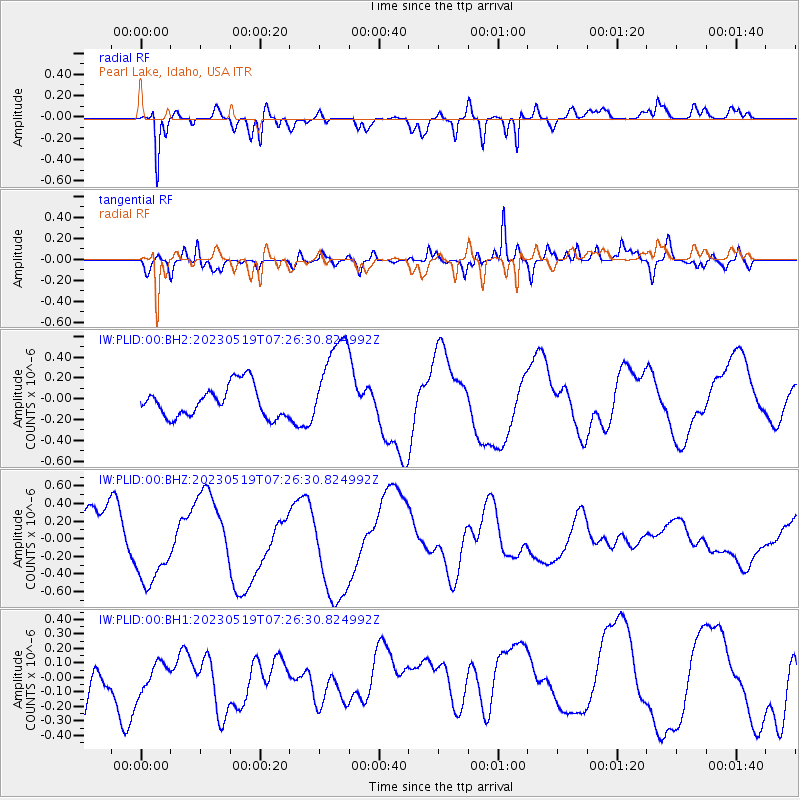
PLID Pearl Lake, Idaho, USA - Earthquake Result Viewer
*The percent match for this event was below the threshold and hence no stack was calculated.
| Earthquake location: |
Southeast Of Loyalty Islands |
| Earthquake latitude/longitude: |
-23.2/170.8 |
| Earthquake time(UTC): |
2023/05/19 (139) 07:13:39 GMT |
| Earthquake Depth: |
10 km |
| Earthquake Magnitude: |
5.5 mb |
| Earthquake Catalog/Contributor: |
NEIC PDE/us |
|
| Network: |
IW Intermountain West |
| Station: |
PLID Pearl Lake, Idaho, USA |
| Lat/Lon: |
45.09 N/116.00 W |
| Elevation: |
2164 m |
|
| Distance: |
95.1 deg |
| Az: |
42.919 deg |
| Baz: |
242.197 deg |
| Ray Param: |
$rayparam |
*The percent match for this event was below the threshold and hence was not used in the summary stack. |
|
| Radial Match: |
84.828964 % |
| Radial Bump: |
400 |
| Transverse Match: |
79.542435 % |
| Transverse Bump: |
400 |
| SOD ConfigId: |
30536071 |
| Insert Time: |
2023-06-02 07:25:39.805 +0000 |
| GWidth: |
2.5 |
| Max Bumps: |
400 |
| Tol: |
0.001 |
|
Signal To Noise
| Channel | StoN | STA | LTA |
| IW:PLID:00:BHZ:20230519T07:26:30.824992Z | 1.7898928 | 4.204628E-7 | 2.349095E-7 |
| IW:PLID:00:BH1:20230519T07:26:30.824992Z | 0.68080467 | 1.1675084E-7 | 1.7148948E-7 |
| IW:PLID:00:BH2:20230519T07:26:30.824992Z | 2.9989786 | 4.507827E-7 | 1.5031208E-7 |
| Arrivals |
| Ps | |
| PpPs | |
| PsPs/PpSs | |


