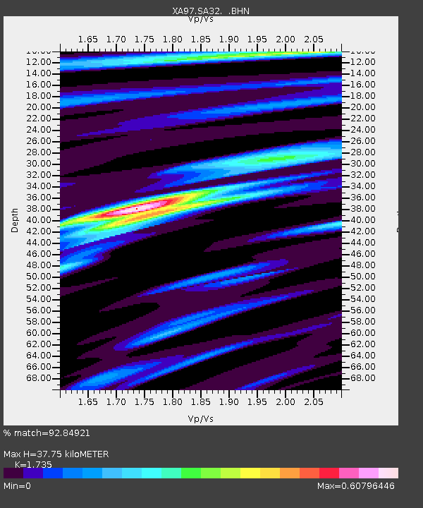
SA32 XA.SA32 - Earthquake Result Viewer
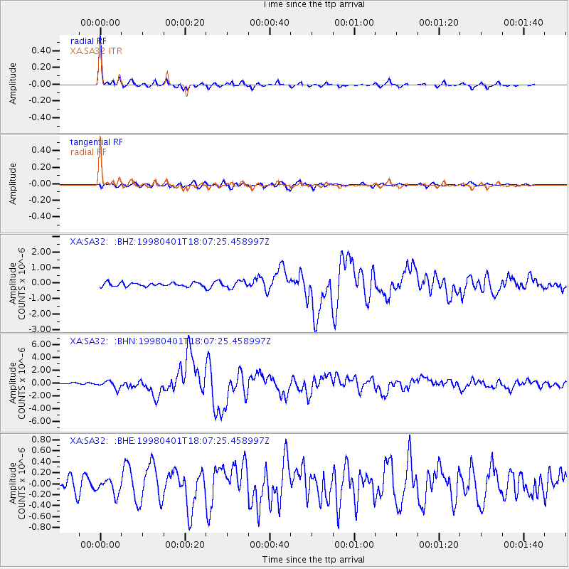
Earthquake location: Southern Sumatra, Indonesia
Earthquake latitude/longitude: -0.5/99.3
Earthquake time(UTC): 1998/04/01 (091) 17:56:23 GMT
Earthquake Depth: 56 km
Earthquake Magnitude: 6.2 MB, 6.9 MS, 7.0 UNKNOWN, 6.6 ME
Earthquake Catalog/Contributor: WHDF/NEIC
Network: XA Anatomy of an Archean Craton, South Africa
Station: SA32 XA.SA32
Lat/Lon: 26.87 S/26.28 E
Elevation: 1380 m
Distance: 74.6 deg
Az: 242.376 deg
Baz: 82.66 deg
Ray Param: 0.05212054
Estimated Moho Depth: 37.75 km
Estimated Crust Vp/Vs: 1.74
Assumed Crust Vp: 6.459 km/s
Estimated Crust Vs: 3.723 km/s
Estimated Crust Poisson's Ratio: 0.25
Radial Match: 92.84921 %
Radial Bump: 279
Transverse Match: 70.12315 %
Transverse Bump: 400
SOD ConfigId: 4480
Insert Time: 2010-02-26 18:10:04.091 +0000
GWidth: 2.5
Max Bumps: 400
Tol: 0.001

Signal To Noise

ChannelStoNSTALTA
XA:SA32: :BHN:19980401T18:07:25.458997Z2.281586.12564E-72.6848238E-7
XA:SA32: :BHE:19980401T18:07:25.458997Z0.972887041.3755809E-71.4139162E-7
XA:SA32: :BHZ:19980401T18:07:25.458997Z1.82384962.1806127E-71.19561E-7
Arrivals
Ps4.4 SECOND
PpPs15 SECOND
PsPs/PpSs20 SECOND