You are here: Home > Network List > TA - USArray Transportable Network (new EarthScope stations) Stations List
> Station U22A Llaves, NM, USA > Earthquake Result Viewer
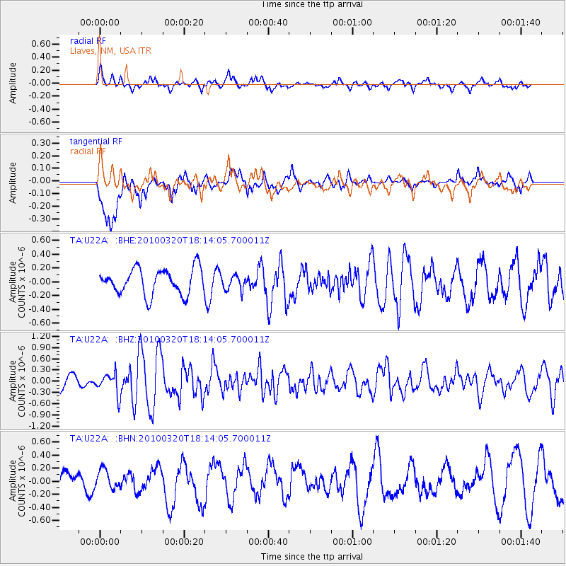
U22A Llaves, NM, USA - Earthquake Result Viewer
*The percent match for this event was below the threshold and hence no stack was calculated.
| Earthquake location: |
Cuba Region |
| Earthquake latitude/longitude: |
19.7/-75.3 |
| Earthquake time(UTC): |
2010/03/20 (079) 18:08:08 GMT |
| Earthquake Depth: |
15 km |
| Earthquake Magnitude: |
5.5 MB, 5.4 MS, 5.6 MW, 5.6 MW |
| Earthquake Catalog/Contributor: |
WHDF/NEIC |
|
| Network: |
TA USArray Transportable Network (new EarthScope stations) |
| Station: |
U22A Llaves, NM, USA |
| Lat/Lon: |
36.38 N/106.85 W |
| Elevation: |
2119 m |
|
| Distance: |
32.2 deg |
| Az: |
307.71 deg |
| Baz: |
112.518 deg |
| Ray Param: |
$rayparam |
*The percent match for this event was below the threshold and hence was not used in the summary stack. |
|
| Radial Match: |
62.352695 % |
| Radial Bump: |
400 |
| Transverse Match: |
66.79833 % |
| Transverse Bump: |
400 |
| SOD ConfigId: |
308276 |
| Insert Time: |
2010-06-22 21:57:53.601 +0000 |
| GWidth: |
2.5 |
| Max Bumps: |
400 |
| Tol: |
0.001 |
|
Signal To Noise
| Channel | StoN | STA | LTA |
| TA:U22A: :BHZ:20100320T18:14:05.700011Z | 1.8593745 | 2.945082E-7 | 1.5839099E-7 |
| TA:U22A: :BHN:20100320T18:14:05.700011Z | 0.70721585 | 1.4751267E-7 | 2.0858224E-7 |
| TA:U22A: :BHE:20100320T18:14:05.700011Z | 0.5682425 | 1.05736014E-7 | 1.8607551E-7 |
| Arrivals |
| Ps | |
| PpPs | |
| PsPs/PpSs | |


