
SA32 XA.SA32 - Earthquake Result Viewer
| ||||||||||||||||||
| ||||||||||||||||||
| ||||||||||||||||||
|
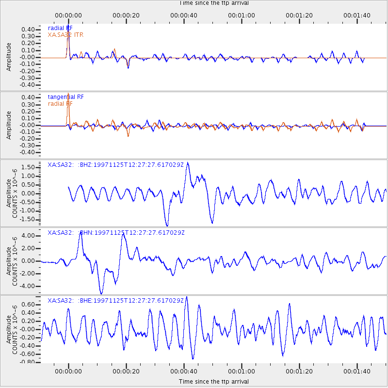
Signal To Noise
| Channel | StoN | STA | LTA |
| XA:SA32: :BHN:19971125T12:27:27.617029Z | 9.368584 | 2.1087035E-6 | 2.2508243E-7 |
| XA:SA32: :BHE:19971125T12:27:27.617029Z | 1.8028532 | 2.516001E-7 | 1.3955663E-7 |
| XA:SA32: :BHZ:19971125T12:27:27.617029Z | 3.2484403 | 8.864679E-7 | 2.7289033E-7 |
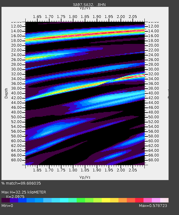
| Arrivals | |
| Ps | 5.6 SECOND |
| PpPs | 15 SECOND |
| PsPs/PpSs | 21 SECOND |

