You are here: Home > Network List > TA - USArray Transportable Network (new EarthScope stations) Stations List
> Station I20A Worland, WY, USA > Earthquake Result Viewer
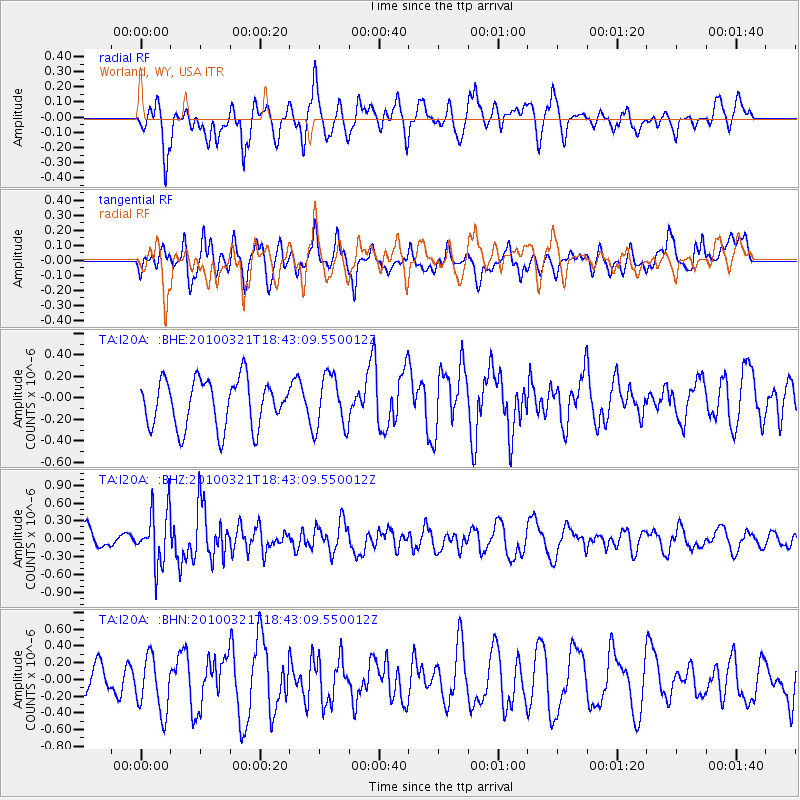
I20A Worland, WY, USA - Earthquake Result Viewer
*The percent match for this event was below the threshold and hence no stack was calculated.
| Earthquake location: |
Near Coast Of Central Chile |
| Earthquake latitude/longitude: |
-36.3/-73.2 |
| Earthquake time(UTC): |
2010/03/21 (080) 18:31:04 GMT |
| Earthquake Depth: |
36 km |
| Earthquake Magnitude: |
5.6 MB, 5.1 MS, 5.5 MW, 5.5 MW |
| Earthquake Catalog/Contributor: |
WHDF/NEIC |
|
| Network: |
TA USArray Transportable Network (new EarthScope stations) |
| Station: |
I20A Worland, WY, USA |
| Lat/Lon: |
43.95 N/108.13 W |
| Elevation: |
1342 m |
|
| Distance: |
86.0 deg |
| Az: |
335.485 deg |
| Baz: |
152.367 deg |
| Ray Param: |
$rayparam |
*The percent match for this event was below the threshold and hence was not used in the summary stack. |
|
| Radial Match: |
51.5821 % |
| Radial Bump: |
400 |
| Transverse Match: |
54.37087 % |
| Transverse Bump: |
400 |
| SOD ConfigId: |
308276 |
| Insert Time: |
2010-06-22 22:16:10.917 +0000 |
| GWidth: |
2.5 |
| Max Bumps: |
400 |
| Tol: |
0.001 |
|
Signal To Noise
| Channel | StoN | STA | LTA |
| TA:I20A: :BHZ:20100321T18:43:09.550012Z | 2.7611358 | 4.4665902E-7 | 1.617664E-7 |
| TA:I20A: :BHN:20100321T18:43:09.550012Z | 1.6821481 | 3.3475197E-7 | 1.9900268E-7 |
| TA:I20A: :BHE:20100321T18:43:09.550012Z | 1.1210293 | 2.4797464E-7 | 2.2120265E-7 |
| Arrivals |
| Ps | |
| PpPs | |
| PsPs/PpSs | |


