You are here: Home > Network List > US - United States National Seismic Network Stations List
> Station AMTX Amarillo, Texas, USA > Earthquake Result Viewer
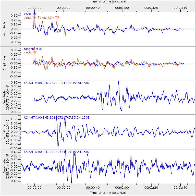
AMTX Amarillo, Texas, USA - Earthquake Result Viewer
*The percent match for this event was below the threshold and hence no stack was calculated.
| Earthquake location: |
Tonga Islands |
| Earthquake latitude/longitude: |
-19.4/-173.3 |
| Earthquake time(UTC): |
2023/05/21 (141) 05:23:11 GMT |
| Earthquake Depth: |
10 km |
| Earthquake Magnitude: |
5.8 Mww |
| Earthquake Catalog/Contributor: |
NEIC PDE/us |
|
| Network: |
US United States National Seismic Network |
| Station: |
AMTX Amarillo, Texas, USA |
| Lat/Lon: |
34.53 N/101.41 W |
| Elevation: |
1010 m |
|
| Distance: |
86.8 deg |
| Az: |
51.816 deg |
| Baz: |
243.976 deg |
| Ray Param: |
$rayparam |
*The percent match for this event was below the threshold and hence was not used in the summary stack. |
|
| Radial Match: |
78.64932 % |
| Radial Bump: |
381 |
| Transverse Match: |
49.161766 % |
| Transverse Bump: |
400 |
| SOD ConfigId: |
30536071 |
| Insert Time: |
2023-06-04 05:43:03.392 +0000 |
| GWidth: |
2.5 |
| Max Bumps: |
400 |
| Tol: |
0.001 |
|
Signal To Noise
| Channel | StoN | STA | LTA |
| US:AMTX:00:BHZ:20230521T05:35:24.150Z | 1.3973345 | 1.0498406E-7 | 7.5131666E-8 |
| US:AMTX:00:BH1:20230521T05:35:24.150Z | 0.53268445 | 4.1216616E-8 | 7.73753E-8 |
| US:AMTX:00:BH2:20230521T05:35:24.150Z | 0.84441346 | 7.862313E-8 | 9.3109755E-8 |
| Arrivals |
| Ps | |
| PpPs | |
| PsPs/PpSs | |


