You are here: Home > Network List > TA - USArray Transportable Network (new EarthScope stations) Stations List
> Station H18A Shoshone NF, Cody, WY, USA > Earthquake Result Viewer
H18A Shoshone NF, Cody, WY, USA - Earthquake Result Viewer
*The percent match for this event was below the threshold and hence no stack was calculated.
| Earthquake location: |
Near Coast Of Central Chile |
| Earthquake latitude/longitude: |
-36.3/-73.2 |
| Earthquake time(UTC): |
2010/03/21 (080) 18:31:04 GMT |
| Earthquake Depth: |
36 km |
| Earthquake Magnitude: |
5.6 MB, 5.1 MS, 5.5 MW, 5.5 MW |
| Earthquake Catalog/Contributor: |
WHDF/NEIC |
|
| Network: |
TA USArray Transportable Network (new EarthScope stations) |
| Station: |
H18A Shoshone NF, Cody, WY, USA |
| Lat/Lon: |
44.68 N/109.66 W |
| Elevation: |
2221 m |
|
| Distance: |
87.2 deg |
| Az: |
334.856 deg |
| Baz: |
151.26 deg |
| Ray Param: |
$rayparam |
*The percent match for this event was below the threshold and hence was not used in the summary stack. |
|
| Radial Match: |
52.362106 % |
| Radial Bump: |
400 |
| Transverse Match: |
48.638405 % |
| Transverse Bump: |
400 |
| SOD ConfigId: |
308276 |
| Insert Time: |
2010-06-22 22:16:55.303 +0000 |
| GWidth: |
2.5 |
| Max Bumps: |
400 |
| Tol: |
0.001 |
|
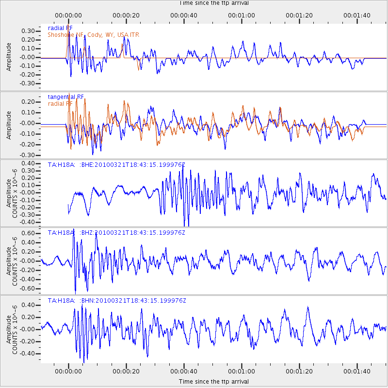
Signal To Noise
| Channel | StoN | STA | LTA |
| TA:H18A: :BHZ:20100321T18:43:15.199976Z | 3.096346 | 3.0490583E-7 | 9.8472796E-8 |
| TA:H18A: :BHN:20100321T18:43:15.199976Z | 1.2464856 | 2.3088468E-7 | 1.8522852E-7 |
| TA:H18A: :BHE:20100321T18:43:15.199976Z | 1.3939518 | 1.3080448E-7 | 9.383717E-8 |
| Arrivals |
| Ps | |
| PpPs | |
| PsPs/PpSs | |


