You are here: Home > Network List > US - United States National Seismic Network Stations List
> Station MNTX Cornudas Mountains, Texas, USA > Earthquake Result Viewer
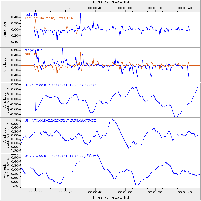
MNTX Cornudas Mountains, Texas, USA - Earthquake Result Viewer
*The percent match for this event was below the threshold and hence no stack was calculated.
| Earthquake location: |
Solomon Islands |
| Earthquake latitude/longitude: |
-10.3/161.4 |
| Earthquake time(UTC): |
2023/05/21 (141) 15:45:13 GMT |
| Earthquake Depth: |
78 km |
| Earthquake Magnitude: |
6.1 Mww |
| Earthquake Catalog/Contributor: |
NEIC PDE/us |
|
| Network: |
US United States National Seismic Network |
| Station: |
MNTX Cornudas Mountains, Texas, USA |
| Lat/Lon: |
31.70 N/105.38 W |
| Elevation: |
405 m |
|
| Distance: |
98.0 deg |
| Az: |
59.254 deg |
| Baz: |
262.892 deg |
| Ray Param: |
$rayparam |
*The percent match for this event was below the threshold and hence was not used in the summary stack. |
|
| Radial Match: |
59.38826 % |
| Radial Bump: |
295 |
| Transverse Match: |
51.68113 % |
| Transverse Bump: |
357 |
| SOD ConfigId: |
30536071 |
| Insert Time: |
2023-06-04 16:02:34.518 +0000 |
| GWidth: |
2.5 |
| Max Bumps: |
400 |
| Tol: |
0.001 |
|
Signal To Noise
| Channel | StoN | STA | LTA |
| US:MNTX:00:BHZ:20230521T15:58:09.07503Z | 0.88996 | 2.575942E-7 | 2.894447E-7 |
| US:MNTX:00:BH1:20230521T15:58:09.07503Z | 1.5795724 | 3.2371722E-7 | 2.0493978E-7 |
| US:MNTX:00:BH2:20230521T15:58:09.07503Z | 0.3329529 | 7.859957E-8 | 2.3606815E-7 |
| Arrivals |
| Ps | |
| PpPs | |
| PsPs/PpSs | |


