You are here: Home > Network List > CI - Caltech Regional Seismic Network Stations List
> Station MPP McPhearson Peak > Earthquake Result Viewer
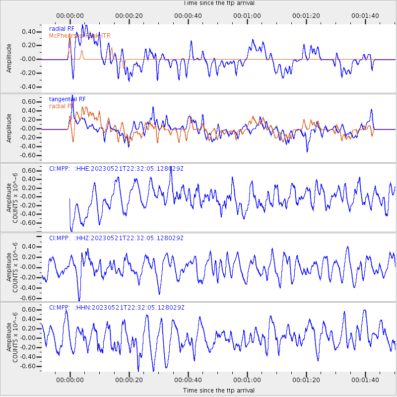
MPP McPhearson Peak - Earthquake Result Viewer
*The percent match for this event was below the threshold and hence no stack was calculated.
| Earthquake location: |
Ryukyu Islands, Japan |
| Earthquake latitude/longitude: |
29.8/129.2 |
| Earthquake time(UTC): |
2023/05/21 (141) 22:20:05 GMT |
| Earthquake Depth: |
189 km |
| Earthquake Magnitude: |
5.5 mww |
| Earthquake Catalog/Contributor: |
NEIC PDE/us |
|
| Network: |
CI Caltech Regional Seismic Network |
| Station: |
MPP McPhearson Peak |
| Lat/Lon: |
34.89 N/119.81 W |
| Elevation: |
1739 m |
|
| Distance: |
88.5 deg |
| Az: |
50.148 deg |
| Baz: |
305.76 deg |
| Ray Param: |
$rayparam |
*The percent match for this event was below the threshold and hence was not used in the summary stack. |
|
| Radial Match: |
34.64496 % |
| Radial Bump: |
400 |
| Transverse Match: |
53.435272 % |
| Transverse Bump: |
400 |
| SOD ConfigId: |
30536071 |
| Insert Time: |
2023-06-04 22:31:07.001 +0000 |
| GWidth: |
2.5 |
| Max Bumps: |
400 |
| Tol: |
0.001 |
|
Signal To Noise
| Channel | StoN | STA | LTA |
| CI:MPP: :HHZ:20230521T22:32:05.128029Z | 1.4504393 | 2.6150354E-7 | 1.8029264E-7 |
| CI:MPP: :HHN:20230521T22:32:05.128029Z | 1.0884627 | 2.3251809E-7 | 2.1362064E-7 |
| CI:MPP: :HHE:20230521T22:32:05.128029Z | 1.0720873 | 3.5106382E-7 | 3.2745825E-7 |
| Arrivals |
| Ps | |
| PpPs | |
| PsPs/PpSs | |


