You are here: Home > Network List > US - United States National Seismic Network Stations List
> Station AMTX Amarillo, Texas, USA > Earthquake Result Viewer
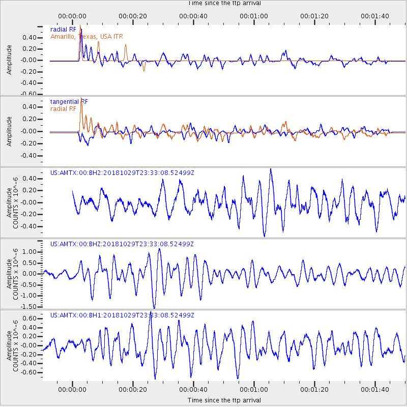
AMTX Amarillo, Texas, USA - Earthquake Result Viewer
*The percent match for this event was below the threshold and hence no stack was calculated.
| Earthquake location: |
Central East Pacific Rise |
| Earthquake latitude/longitude: |
-4.6/-105.9 |
| Earthquake time(UTC): |
2018/10/29 (302) 23:26:09 GMT |
| Earthquake Depth: |
10 km |
| Earthquake Magnitude: |
5.8 Mww |
| Earthquake Catalog/Contributor: |
NEIC PDE/us |
|
| Network: |
US United States National Seismic Network |
| Station: |
AMTX Amarillo, Texas, USA |
| Lat/Lon: |
34.53 N/101.41 W |
| Elevation: |
1010 m |
|
| Distance: |
39.1 deg |
| Az: |
5.894 deg |
| Baz: |
187.122 deg |
| Ray Param: |
$rayparam |
*The percent match for this event was below the threshold and hence was not used in the summary stack. |
|
| Radial Match: |
78.23043 % |
| Radial Bump: |
400 |
| Transverse Match: |
66.71655 % |
| Transverse Bump: |
400 |
| SOD ConfigId: |
3103472 |
| Insert Time: |
2018-11-12 23:32:18.596 +0000 |
| GWidth: |
2.5 |
| Max Bumps: |
400 |
| Tol: |
0.001 |
|
Signal To Noise
| Channel | StoN | STA | LTA |
| US:AMTX:00:BHZ:20181029T23:33:08.52499Z | 2.1102536 | 2.5625584E-7 | 1.2143367E-7 |
| US:AMTX:00:BH1:20181029T23:33:08.52499Z | 0.75894636 | 8.373369E-8 | 1.1032886E-7 |
| US:AMTX:00:BH2:20181029T23:33:08.52499Z | 1.8152851 | 2.0396122E-7 | 1.12357675E-7 |
| Arrivals |
| Ps | |
| PpPs | |
| PsPs/PpSs | |


