You are here: Home > Network List > US - United States National Seismic Network Stations List
> Station DGMT Dagmar, Montana, USA > Earthquake Result Viewer
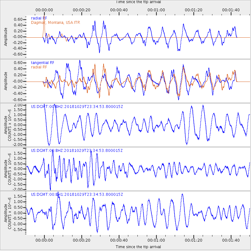
DGMT Dagmar, Montana, USA - Earthquake Result Viewer
*The percent match for this event was below the threshold and hence no stack was calculated.
| Earthquake location: |
Central East Pacific Rise |
| Earthquake latitude/longitude: |
-4.6/-105.9 |
| Earthquake time(UTC): |
2018/10/29 (302) 23:26:09 GMT |
| Earthquake Depth: |
10 km |
| Earthquake Magnitude: |
5.8 Mww |
| Earthquake Catalog/Contributor: |
NEIC PDE/us |
|
| Network: |
US United States National Seismic Network |
| Station: |
DGMT Dagmar, Montana, USA |
| Lat/Lon: |
48.47 N/104.20 W |
| Elevation: |
0.0 m |
|
| Distance: |
52.8 deg |
| Az: |
1.432 deg |
| Baz: |
182.145 deg |
| Ray Param: |
$rayparam |
*The percent match for this event was below the threshold and hence was not used in the summary stack. |
|
| Radial Match: |
62.15125 % |
| Radial Bump: |
400 |
| Transverse Match: |
61.266525 % |
| Transverse Bump: |
400 |
| SOD ConfigId: |
3103472 |
| Insert Time: |
2018-11-12 23:32:30.886 +0000 |
| GWidth: |
2.5 |
| Max Bumps: |
400 |
| Tol: |
0.001 |
|
Signal To Noise
| Channel | StoN | STA | LTA |
| US:DGMT:00:BHZ:20181029T23:34:53.800015Z | 4.571562 | 9.628197E-7 | 2.106107E-7 |
| US:DGMT:00:BH1:20181029T23:34:53.800015Z | 0.82767403 | 4.990035E-7 | 6.028986E-7 |
| US:DGMT:00:BH2:20181029T23:34:53.800015Z | 0.4550743 | 4.738333E-7 | 1.0412218E-6 |
| Arrivals |
| Ps | |
| PpPs | |
| PsPs/PpSs | |


