You are here: Home > Network List > WY - Yellowstone Wyoming Seismic Network Stations List
> Station YHH Holmes Hill, YNP, WY, USA > Earthquake Result Viewer
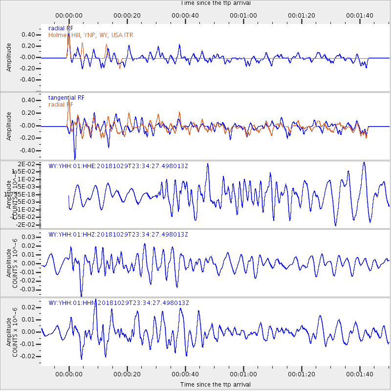
YHH Holmes Hill, YNP, WY, USA - Earthquake Result Viewer
*The percent match for this event was below the threshold and hence no stack was calculated.
| Earthquake location: |
Central East Pacific Rise |
| Earthquake latitude/longitude: |
-4.6/-105.9 |
| Earthquake time(UTC): |
2018/10/29 (302) 23:26:09 GMT |
| Earthquake Depth: |
10 km |
| Earthquake Magnitude: |
5.8 Mww |
| Earthquake Catalog/Contributor: |
NEIC PDE/us |
|
| Network: |
WY Yellowstone Wyoming Seismic Network |
| Station: |
YHH Holmes Hill, YNP, WY, USA |
| Lat/Lon: |
44.79 N/110.85 W |
| Elevation: |
2717 m |
|
| Distance: |
49.3 deg |
| Az: |
355.363 deg |
| Baz: |
173.501 deg |
| Ray Param: |
$rayparam |
*The percent match for this event was below the threshold and hence was not used in the summary stack. |
|
| Radial Match: |
68.424866 % |
| Radial Bump: |
400 |
| Transverse Match: |
63.663044 % |
| Transverse Bump: |
400 |
| SOD ConfigId: |
3103472 |
| Insert Time: |
2018-11-12 23:34:44.086 +0000 |
| GWidth: |
2.5 |
| Max Bumps: |
400 |
| Tol: |
0.001 |
|
Signal To Noise
| Channel | StoN | STA | LTA |
| WY:YHH:01:HHZ:20181029T23:34:27.498013Z | 3.604801 | 1.45499515E-8 | 4.0362704E-9 |
| WY:YHH:01:HHN:20181029T23:34:27.498013Z | 2.3111463 | 8.364491E-9 | 3.6191958E-9 |
| WY:YHH:01:HHE:20181029T23:34:27.498013Z | 0.93647593 | 4.283474E-9 | 4.5740354E-9 |
| Arrivals |
| Ps | |
| PpPs | |
| PsPs/PpSs | |


