You are here: Home > Network List > G - GEOSCOPE Stations List
> Station TAOE Taiohae, Marquises islands > Earthquake Result Viewer
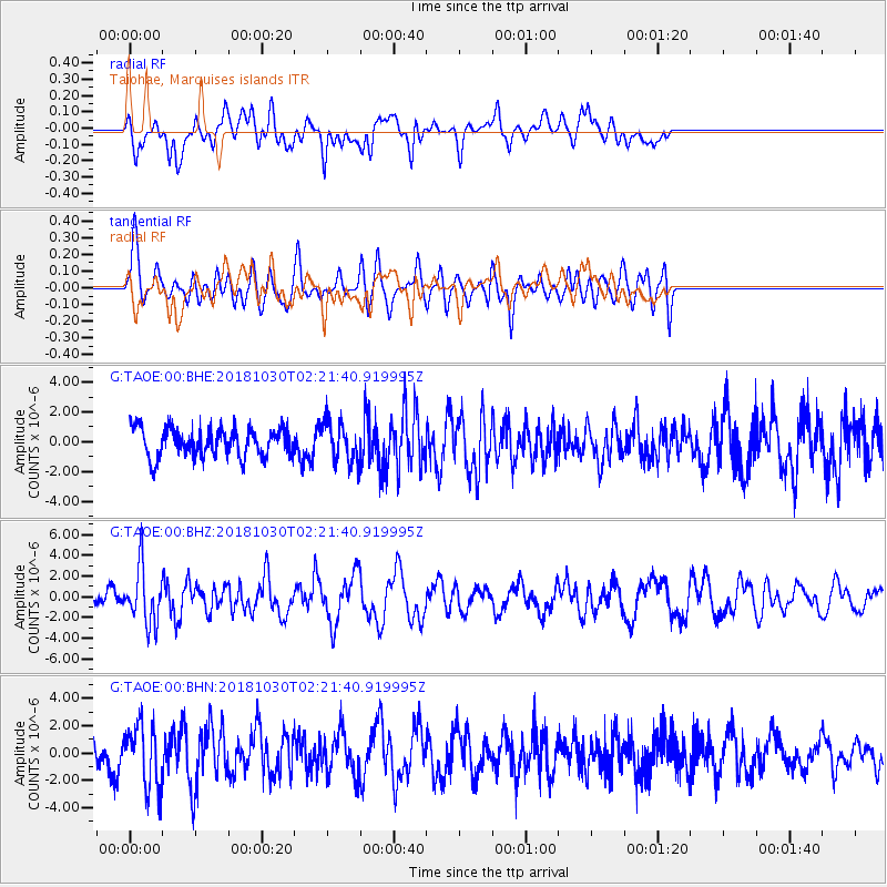
TAOE Taiohae, Marquises islands - Earthquake Result Viewer
*The percent match for this event was below the threshold and hence no stack was calculated.
| Earthquake location: |
North Island, New Zealand |
| Earthquake latitude/longitude: |
-39.1/175.0 |
| Earthquake time(UTC): |
2018/10/30 (303) 02:13:39 GMT |
| Earthquake Depth: |
227 km |
| Earthquake Magnitude: |
6.1 Mww |
| Earthquake Catalog/Contributor: |
NEIC PDE/us |
|
| Network: |
G GEOSCOPE |
| Station: |
TAOE Taiohae, Marquises islands |
| Lat/Lon: |
8.85 S/140.15 W |
| Elevation: |
800 m |
|
| Distance: |
50.1 deg |
| Az: |
65.323 deg |
| Baz: |
225.72 deg |
| Ray Param: |
$rayparam |
*The percent match for this event was below the threshold and hence was not used in the summary stack. |
|
| Radial Match: |
55.626415 % |
| Radial Bump: |
400 |
| Transverse Match: |
59.937057 % |
| Transverse Bump: |
400 |
| SOD ConfigId: |
3103472 |
| Insert Time: |
2018-11-13 02:26:11.069 +0000 |
| GWidth: |
2.5 |
| Max Bumps: |
400 |
| Tol: |
0.001 |
|
Signal To Noise
| Channel | StoN | STA | LTA |
| G:TAOE:00:BHZ:20181030T02:21:40.919995Z | 3.16901 | 2.6784758E-6 | 8.45209E-7 |
| G:TAOE:00:BHN:20181030T02:21:40.919995Z | 2.3183627 | 2.3306163E-6 | 1.0052855E-6 |
| G:TAOE:00:BHE:20181030T02:21:40.919995Z | 1.3676307 | 1.329154E-6 | 9.718661E-7 |
| Arrivals |
| Ps | |
| PpPs | |
| PsPs/PpSs | |


