HKT Hockley, Texas - Earthquake Result Viewer
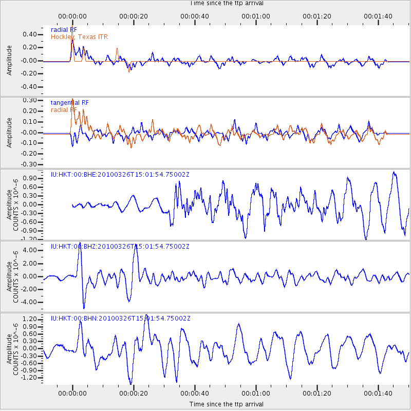
Earthquake location: Near Coast Of Northern Chile
Earthquake latitude/longitude: -28.0/-70.8
Earthquake time(UTC): 2010/03/26 (085) 14:52:07 GMT
Earthquake Depth: 42 km
Earthquake Magnitude: 6.2 MB, 5.9 MS, 6.3 MW, 6.1 MW
Earthquake Catalog/Contributor: WHDF/NEIC
Network: IU Global Seismograph Network (GSN - IRIS/USGS)
Station: HKT Hockley, Texas
Lat/Lon: 29.96 N/95.84 W
Elevation: -413.0 m
Distance: 62.4 deg
Az: 335.526 deg
Baz: 155.02 deg
Ray Param: 0.060195606
Estimated Moho Depth: 34.5 km
Estimated Crust Vp/Vs: 1.60
Assumed Crust Vp: 5.581 km/s
Estimated Crust Vs: 3.488 km/s
Estimated Crust Poisson's Ratio: 0.18
Radial Match: 85.76018 %
Radial Bump: 378
Transverse Match: 72.818375 %
Transverse Bump: 378
SOD ConfigId: 312771
Insert Time: 2010-06-28 16:17:13.547 +0000
GWidth: 2.5
Max Bumps: 400
Tol: 0.001

Signal To Noise

ChannelStoNSTALTA
IU:HKT:00:BHZ:20100326T15:01:54.75002Z16.5875872.6529756E-61.599374E-7
IU:HKT:00:BHN:20100326T15:01:54.75002Z1.81625214.940747E-72.720298E-7
IU:HKT:00:BHE:20100326T15:01:54.75002Z3.46296574.0850364E-71.1796353E-7
Arrivals
Ps3.8 SECOND
PpPs15 SECOND
PsPs/PpSs19 SECOND