You are here: Home > Network List > TX - Texas Seismological Network Stations List
> Station WTFS Witchita Falls > Earthquake Result Viewer
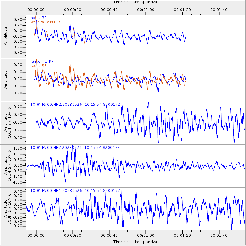
WTFS Witchita Falls - Earthquake Result Viewer
*The percent match for this event was below the threshold and hence no stack was calculated.
| Earthquake location: |
Near East Coast Of Honshu, Japan |
| Earthquake latitude/longitude: |
35.6/140.7 |
| Earthquake time(UTC): |
2023/05/26 (146) 10:03:24 GMT |
| Earthquake Depth: |
44 km |
| Earthquake Magnitude: |
6.2 mww |
| Earthquake Catalog/Contributor: |
NEIC PDE/us |
|
| Network: |
TX Texas Seismological Network |
| Station: |
WTFS Witchita Falls |
| Lat/Lon: |
33.77 N/98.46 W |
| Elevation: |
277 m |
|
| Distance: |
91.6 deg |
| Az: |
45.674 deg |
| Baz: |
315.596 deg |
| Ray Param: |
$rayparam |
*The percent match for this event was below the threshold and hence was not used in the summary stack. |
|
| Radial Match: |
67.5104 % |
| Radial Bump: |
334 |
| Transverse Match: |
53.875923 % |
| Transverse Bump: |
374 |
| SOD ConfigId: |
30536071 |
| Insert Time: |
2023-06-09 10:35:31.781 +0000 |
| GWidth: |
2.5 |
| Max Bumps: |
400 |
| Tol: |
0.001 |
|
Signal To Noise
| Channel | StoN | STA | LTA |
| TX:WTFS:00:HHZ:20230526T10:15:54.820017Z | 3.0322335 | 3.0394224E-7 | 1.0023709E-7 |
| TX:WTFS:00:HH1:20230526T10:15:54.820017Z | 1.070861 | 1.2634224E-7 | 1.1798193E-7 |
| TX:WTFS:00:HH2:20230526T10:15:54.820017Z | 2.0769217 | 1.6838683E-7 | 8.107519E-8 |
| Arrivals |
| Ps | |
| PpPs | |
| PsPs/PpSs | |


