You are here: Home > Network List > TA - USArray Transportable Network (new EarthScope stations) Stations List
> Station X16A Lo Mia Camp, Pine, AZ, USA > Earthquake Result Viewer
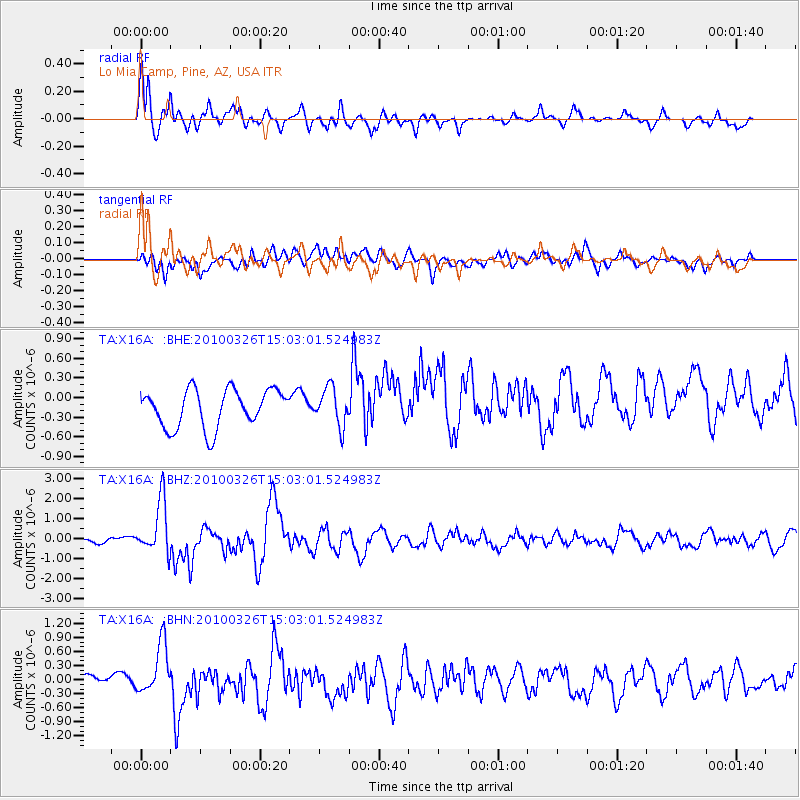
X16A Lo Mia Camp, Pine, AZ, USA - Earthquake Result Viewer
*The percent match for this event was below the threshold and hence no stack was calculated.
| Earthquake location: |
Near Coast Of Northern Chile |
| Earthquake latitude/longitude: |
-28.0/-70.8 |
| Earthquake time(UTC): |
2010/03/26 (085) 14:52:07 GMT |
| Earthquake Depth: |
42 km |
| Earthquake Magnitude: |
6.2 MB, 5.9 MS, 6.3 MW, 6.1 MW |
| Earthquake Catalog/Contributor: |
WHDF/NEIC |
|
| Network: |
TA USArray Transportable Network (new EarthScope stations) |
| Station: |
X16A Lo Mia Camp, Pine, AZ, USA |
| Lat/Lon: |
34.42 N/111.44 W |
| Elevation: |
1759 m |
|
| Distance: |
73.0 deg |
| Az: |
325.745 deg |
| Baz: |
142.964 deg |
| Ray Param: |
$rayparam |
*The percent match for this event was below the threshold and hence was not used in the summary stack. |
|
| Radial Match: |
78.003624 % |
| Radial Bump: |
400 |
| Transverse Match: |
51.58845 % |
| Transverse Bump: |
400 |
| SOD ConfigId: |
312771 |
| Insert Time: |
2010-06-28 16:22:01.584 +0000 |
| GWidth: |
2.5 |
| Max Bumps: |
400 |
| Tol: |
0.001 |
|
Signal To Noise
| Channel | StoN | STA | LTA |
| TA:X16A: :BHZ:20100326T15:03:01.524983Z | 9.277749 | 1.3251773E-6 | 1.4283393E-7 |
| TA:X16A: :BHN:20100326T15:03:01.524983Z | 2.0739696 | 5.4212336E-7 | 2.613941E-7 |
| TA:X16A: :BHE:20100326T15:03:01.524983Z | 0.9983207 | 2.8820418E-7 | 2.8868897E-7 |
| Arrivals |
| Ps | |
| PpPs | |
| PsPs/PpSs | |


