You are here: Home > Network List > US - United States National Seismic Network Stations List
> Station AMTX Amarillo, Texas, USA > Earthquake Result Viewer
AMTX Amarillo, Texas, USA - Earthquake Result Viewer
*The percent match for this event was below the threshold and hence no stack was calculated.
| Earthquake location: |
Ionian Sea |
| Earthquake latitude/longitude: |
37.5/20.5 |
| Earthquake time(UTC): |
2018/10/30 (303) 15:12:00 GMT |
| Earthquake Depth: |
11 km |
| Earthquake Magnitude: |
5.7 Mww |
| Earthquake Catalog/Contributor: |
NEIC PDE/us |
|
| Network: |
US United States National Seismic Network |
| Station: |
AMTX Amarillo, Texas, USA |
| Lat/Lon: |
34.53 N/101.41 W |
| Elevation: |
1010 m |
|
| Distance: |
90.3 deg |
| Az: |
315.509 deg |
| Baz: |
42.453 deg |
| Ray Param: |
$rayparam |
*The percent match for this event was below the threshold and hence was not used in the summary stack. |
|
| Radial Match: |
46.252934 % |
| Radial Bump: |
400 |
| Transverse Match: |
48.676895 % |
| Transverse Bump: |
400 |
| SOD ConfigId: |
3103472 |
| Insert Time: |
2018-11-13 15:29:56.683 +0000 |
| GWidth: |
2.5 |
| Max Bumps: |
400 |
| Tol: |
0.001 |
|
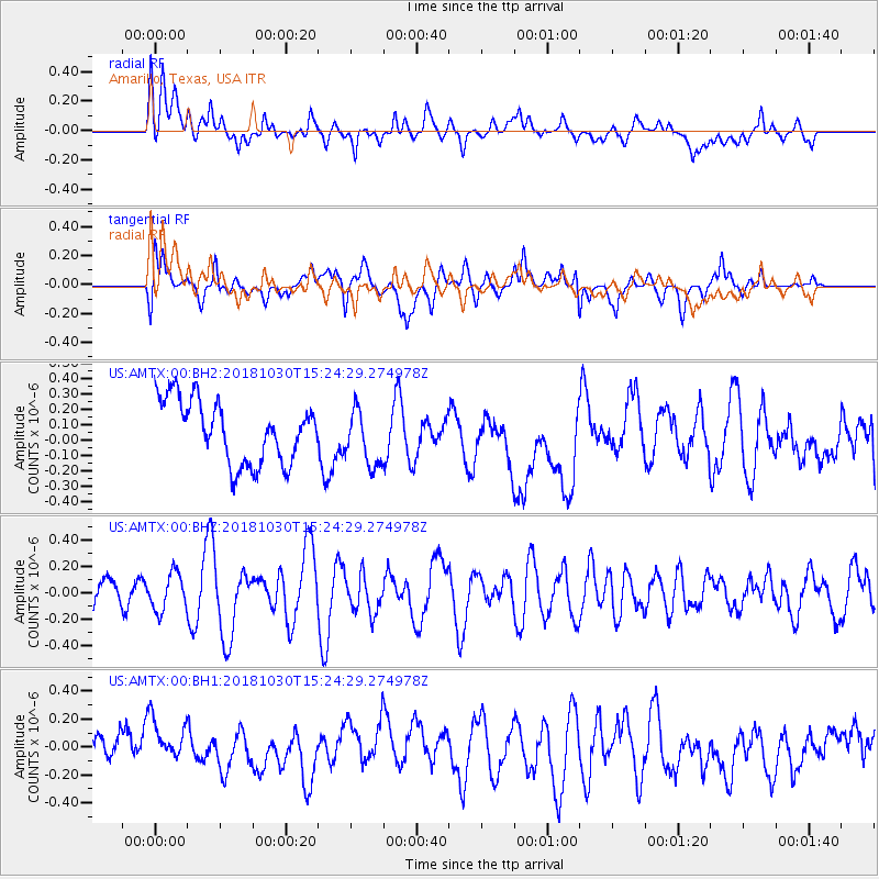
Signal To Noise
| Channel | StoN | STA | LTA |
| US:AMTX:00:BHZ:20181030T15:24:29.274978Z | 0.8608374 | 1.371619E-7 | 1.5933544E-7 |
| US:AMTX:00:BH1:20181030T15:24:29.274978Z | 1.0856689 | 1.7337642E-7 | 1.5969547E-7 |
| US:AMTX:00:BH2:20181030T15:24:29.274978Z | 0.9427242 | 1.8766072E-7 | 1.9906216E-7 |
| Arrivals |
| Ps | |
| PpPs | |
| PsPs/PpSs | |


