You are here: Home > Network List > CI - Caltech Regional Seismic Network Stations List
> Station MPP McPhearson Peak > Earthquake Result Viewer
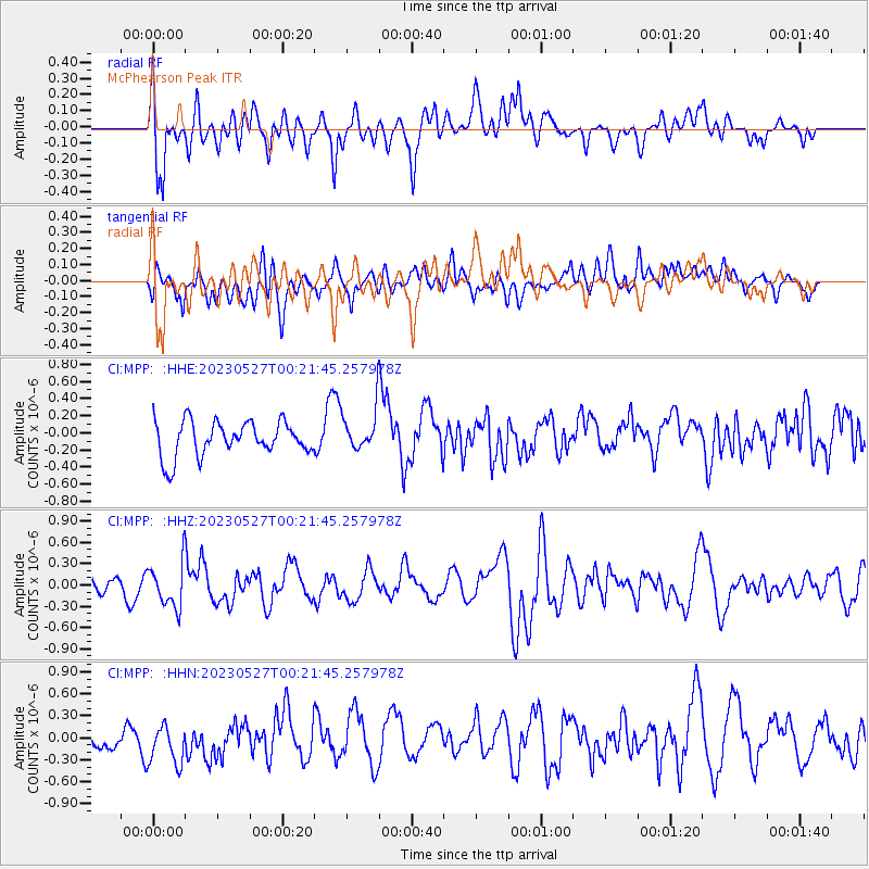
MPP McPhearson Peak - Earthquake Result Viewer
*The percent match for this event was below the threshold and hence no stack was calculated.
| Earthquake location: |
Tonga Islands |
| Earthquake latitude/longitude: |
-18.5/-175.2 |
| Earthquake time(UTC): |
2023/05/27 (147) 00:11:00 GMT |
| Earthquake Depth: |
215 km |
| Earthquake Magnitude: |
6.0 mww |
| Earthquake Catalog/Contributor: |
NEIC PDE/us |
|
| Network: |
CI Caltech Regional Seismic Network |
| Station: |
MPP McPhearson Peak |
| Lat/Lon: |
34.89 N/119.81 W |
| Elevation: |
1739 m |
|
| Distance: |
74.7 deg |
| Az: |
44.544 deg |
| Baz: |
234.089 deg |
| Ray Param: |
$rayparam |
*The percent match for this event was below the threshold and hence was not used in the summary stack. |
|
| Radial Match: |
66.9904 % |
| Radial Bump: |
400 |
| Transverse Match: |
55.018295 % |
| Transverse Bump: |
400 |
| SOD ConfigId: |
30536071 |
| Insert Time: |
2023-06-10 00:25:41.541 +0000 |
| GWidth: |
2.5 |
| Max Bumps: |
400 |
| Tol: |
0.001 |
|
Signal To Noise
| Channel | StoN | STA | LTA |
| CI:MPP: :HHZ:20230527T00:21:45.257978Z | 2.4152968 | 3.0921484E-7 | 1.2802354E-7 |
| CI:MPP: :HHN:20230527T00:21:45.257978Z | 2.302138 | 2.8558694E-7 | 1.2405292E-7 |
| CI:MPP: :HHE:20230527T00:21:45.257978Z | 1.2007911 | 2.4008398E-7 | 1.9993816E-7 |
| Arrivals |
| Ps | |
| PpPs | |
| PsPs/PpSs | |


