You are here: Home > Network List > CN - Canadian National Seismograph Network Stations List
> Station INK INUVIK, NT > Earthquake Result Viewer
INK INUVIK, NT - Earthquake Result Viewer
*The percent match for this event was below the threshold and hence no stack was calculated.
| Earthquake location: |
Tonga Islands |
| Earthquake latitude/longitude: |
-18.5/-175.2 |
| Earthquake time(UTC): |
2023/05/27 (147) 00:11:00 GMT |
| Earthquake Depth: |
215 km |
| Earthquake Magnitude: |
6.0 mww |
| Earthquake Catalog/Contributor: |
NEIC PDE/us |
|
| Network: |
CN Canadian National Seismograph Network |
| Station: |
INK INUVIK, NT |
| Lat/Lon: |
68.31 N/133.53 W |
| Elevation: |
44 m |
|
| Distance: |
91.6 deg |
| Az: |
14.318 deg |
| Baz: |
219.151 deg |
| Ray Param: |
$rayparam |
*The percent match for this event was below the threshold and hence was not used in the summary stack. |
|
| Radial Match: |
59.69208 % |
| Radial Bump: |
400 |
| Transverse Match: |
60.706535 % |
| Transverse Bump: |
400 |
| SOD ConfigId: |
30536071 |
| Insert Time: |
2023-06-10 00:27:05.905 +0000 |
| GWidth: |
2.5 |
| Max Bumps: |
400 |
| Tol: |
0.001 |
|
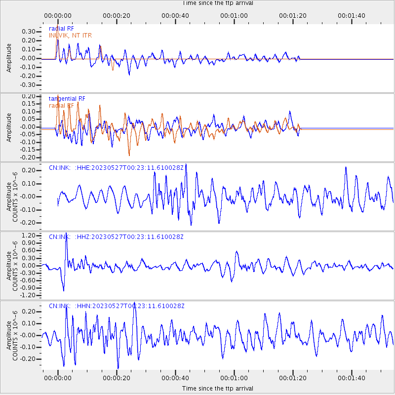
Signal To Noise
| Channel | StoN | STA | LTA |
| CN:INK: :HHZ:20230527T00:23:11.610028Z | 8.992358 | 5.0666597E-7 | 5.6344057E-8 |
| CN:INK: :HHN:20230527T00:23:11.610028Z | 2.6590817 | 1.2210664E-7 | 4.5920608E-8 |
| CN:INK: :HHE:20230527T00:23:11.610028Z | 1.5054007 | 7.539348E-8 | 5.0082004E-8 |
| Arrivals |
| Ps | |
| PpPs | |
| PsPs/PpSs | |


