You are here: Home > Network List > G - GEOSCOPE Stations List
> Station INU Inuyama, Japan > Earthquake Result Viewer
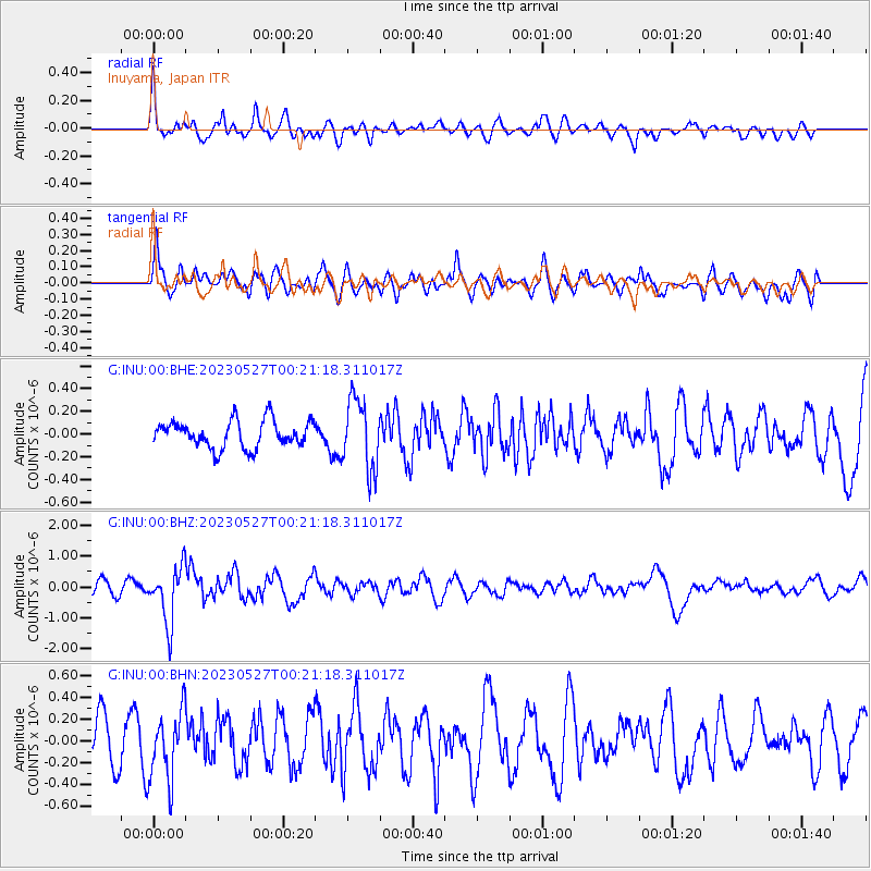
INU Inuyama, Japan - Earthquake Result Viewer
*The percent match for this event was below the threshold and hence no stack was calculated.
| Earthquake location: |
Tonga Islands |
| Earthquake latitude/longitude: |
-18.5/-175.2 |
| Earthquake time(UTC): |
2023/05/27 (147) 00:11:00 GMT |
| Earthquake Depth: |
215 km |
| Earthquake Magnitude: |
6.0 mww |
| Earthquake Catalog/Contributor: |
NEIC PDE/us |
|
| Network: |
G GEOSCOPE |
| Station: |
INU Inuyama, Japan |
| Lat/Lon: |
35.35 N/137.03 E |
| Elevation: |
132 m |
|
| Distance: |
70.1 deg |
| Az: |
319.931 deg |
| Baz: |
131.63 deg |
| Ray Param: |
$rayparam |
*The percent match for this event was below the threshold and hence was not used in the summary stack. |
|
| Radial Match: |
57.80758 % |
| Radial Bump: |
400 |
| Transverse Match: |
49.155197 % |
| Transverse Bump: |
400 |
| SOD ConfigId: |
30536071 |
| Insert Time: |
2023-06-10 00:28:20.093 +0000 |
| GWidth: |
2.5 |
| Max Bumps: |
400 |
| Tol: |
0.001 |
|
Signal To Noise
| Channel | StoN | STA | LTA |
| G:INU:00:BHZ:20230527T00:21:18.311017Z | 3.7940242 | 9.1491694E-7 | 2.4114684E-7 |
| G:INU:00:BHN:20230527T00:21:18.311017Z | 0.95815325 | 3.200215E-7 | 3.3399826E-7 |
| G:INU:00:BHE:20230527T00:21:18.311017Z | 2.608212 | 3.0860718E-7 | 1.1832136E-7 |
| Arrivals |
| Ps | |
| PpPs | |
| PsPs/PpSs | |


