You are here: Home > Network List > IW - Intermountain West Stations List
> Station MOOW Moose Ponds, Wyoming, USA > Earthquake Result Viewer
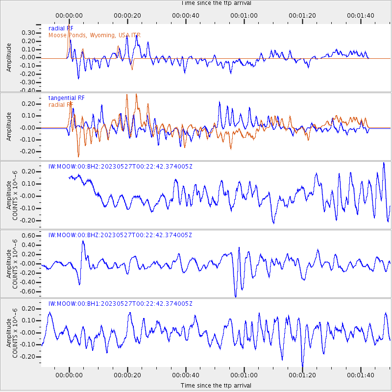
MOOW Moose Ponds, Wyoming, USA - Earthquake Result Viewer
*The percent match for this event was below the threshold and hence no stack was calculated.
| Earthquake location: |
Tonga Islands |
| Earthquake latitude/longitude: |
-18.5/-175.2 |
| Earthquake time(UTC): |
2023/05/27 (147) 00:11:00 GMT |
| Earthquake Depth: |
215 km |
| Earthquake Magnitude: |
6.0 mww |
| Earthquake Catalog/Contributor: |
NEIC PDE/us |
|
| Network: |
IW Intermountain West |
| Station: |
MOOW Moose Ponds, Wyoming, USA |
| Lat/Lon: |
43.75 N/110.74 W |
| Elevation: |
2128 m |
|
| Distance: |
85.4 deg |
| Az: |
40.991 deg |
| Baz: |
239.221 deg |
| Ray Param: |
$rayparam |
*The percent match for this event was below the threshold and hence was not used in the summary stack. |
|
| Radial Match: |
55.16289 % |
| Radial Bump: |
400 |
| Transverse Match: |
45.827488 % |
| Transverse Bump: |
400 |
| SOD ConfigId: |
30536071 |
| Insert Time: |
2023-06-10 00:30:41.938 +0000 |
| GWidth: |
2.5 |
| Max Bumps: |
400 |
| Tol: |
0.001 |
|
Signal To Noise
| Channel | StoN | STA | LTA |
| IW:MOOW:00:BHZ:20230527T00:22:42.374005Z | 4.0008807 | 2.1673242E-7 | 5.417118E-8 |
| IW:MOOW:00:BH1:20230527T00:22:42.374005Z | 1.1497464 | 8.5931724E-8 | 7.4739724E-8 |
| IW:MOOW:00:BH2:20230527T00:22:42.374005Z | 0.9254004 | 7.8768686E-8 | 8.51185E-8 |
| Arrivals |
| Ps | |
| PpPs | |
| PsPs/PpSs | |


