You are here: Home > Network List > US - United States National Seismic Network Stations List
> Station DGMT Dagmar, Montana, USA > Earthquake Result Viewer
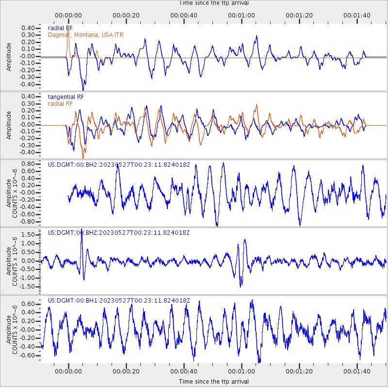
DGMT Dagmar, Montana, USA - Earthquake Result Viewer
*The percent match for this event was below the threshold and hence no stack was calculated.
| Earthquake location: |
Tonga Islands |
| Earthquake latitude/longitude: |
-18.5/-175.2 |
| Earthquake time(UTC): |
2023/05/27 (147) 00:11:00 GMT |
| Earthquake Depth: |
215 km |
| Earthquake Magnitude: |
6.0 mww |
| Earthquake Catalog/Contributor: |
NEIC PDE/us |
|
| Network: |
US United States National Seismic Network |
| Station: |
DGMT Dagmar, Montana, USA |
| Lat/Lon: |
48.47 N/104.20 W |
| Elevation: |
646 m |
|
| Distance: |
91.7 deg |
| Az: |
39.015 deg |
| Baz: |
243.882 deg |
| Ray Param: |
$rayparam |
*The percent match for this event was below the threshold and hence was not used in the summary stack. |
|
| Radial Match: |
59.528526 % |
| Radial Bump: |
400 |
| Transverse Match: |
48.036453 % |
| Transverse Bump: |
378 |
| SOD ConfigId: |
30536071 |
| Insert Time: |
2023-06-10 00:41:19.094 +0000 |
| GWidth: |
2.5 |
| Max Bumps: |
400 |
| Tol: |
0.001 |
|
Signal To Noise
| Channel | StoN | STA | LTA |
| US:DGMT:00:BHZ:20230527T00:23:11.824018Z | 3.6717856 | 5.441105E-7 | 1.4818688E-7 |
| US:DGMT:00:BH1:20230527T00:23:11.824018Z | 0.8572611 | 2.3876947E-7 | 2.7852593E-7 |
| US:DGMT:00:BH2:20230527T00:23:11.824018Z | 0.97062904 | 2.366076E-7 | 2.437673E-7 |
| Arrivals |
| Ps | |
| PpPs | |
| PsPs/PpSs | |


