You are here: Home > Network List > US - United States National Seismic Network Stations List
> Station MSO Missoula, Montana, USA > Earthquake Result Viewer
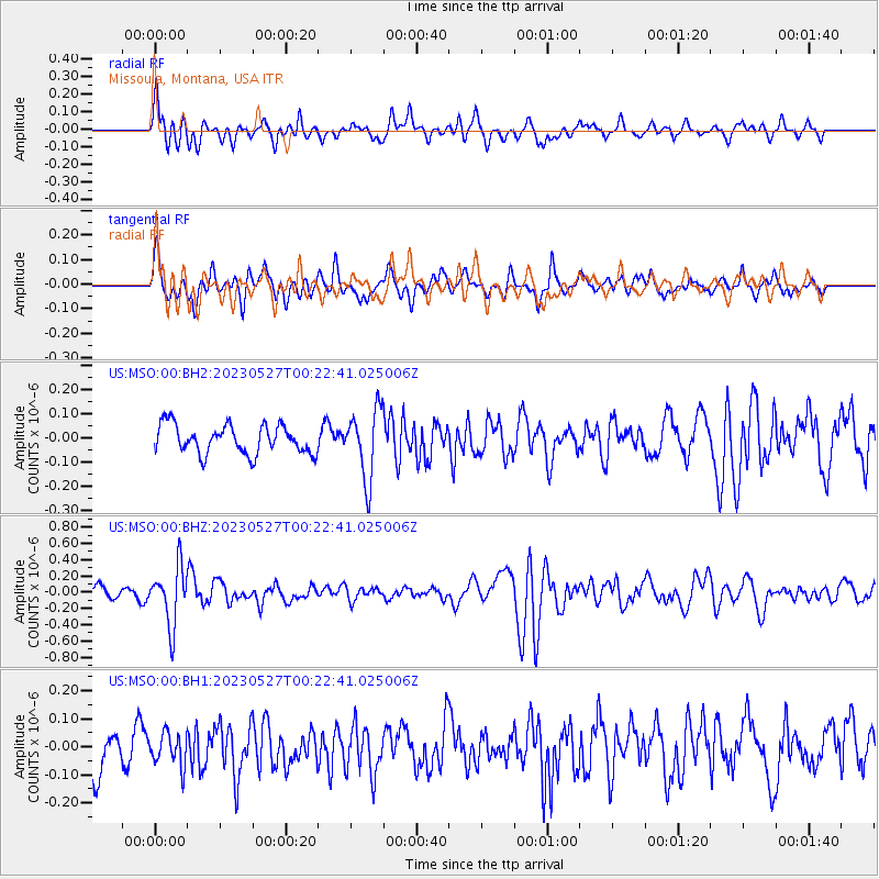
MSO Missoula, Montana, USA - Earthquake Result Viewer
*The percent match for this event was below the threshold and hence no stack was calculated.
| Earthquake location: |
Tonga Islands |
| Earthquake latitude/longitude: |
-18.5/-175.2 |
| Earthquake time(UTC): |
2023/05/27 (147) 00:11:00 GMT |
| Earthquake Depth: |
215 km |
| Earthquake Magnitude: |
6.0 mww |
| Earthquake Catalog/Contributor: |
NEIC PDE/us |
|
| Network: |
US United States National Seismic Network |
| Station: |
MSO Missoula, Montana, USA |
| Lat/Lon: |
46.83 N/113.94 W |
| Elevation: |
1264 m |
|
| Distance: |
85.1 deg |
| Az: |
37.171 deg |
| Baz: |
236.642 deg |
| Ray Param: |
$rayparam |
*The percent match for this event was below the threshold and hence was not used in the summary stack. |
|
| Radial Match: |
73.77185 % |
| Radial Bump: |
400 |
| Transverse Match: |
62.83247 % |
| Transverse Bump: |
400 |
| SOD ConfigId: |
30536071 |
| Insert Time: |
2023-06-10 00:41:37.484 +0000 |
| GWidth: |
2.5 |
| Max Bumps: |
400 |
| Tol: |
0.001 |
|
Signal To Noise
| Channel | StoN | STA | LTA |
| US:MSO:00:BHZ:20230527T00:22:41.025006Z | 6.23801 | 3.5815683E-7 | 5.741524E-8 |
| US:MSO:00:BH1:20230527T00:22:41.025006Z | 0.8646138 | 5.7701488E-8 | 6.673672E-8 |
| US:MSO:00:BH2:20230527T00:22:41.025006Z | 2.4370198 | 1.4274285E-7 | 5.857271E-8 |
| Arrivals |
| Ps | |
| PpPs | |
| PsPs/PpSs | |


