You are here: Home > Network List > UU - University of Utah Regional Network Stations List
> Station CCUT Cedar City, UT, USA > Earthquake Result Viewer
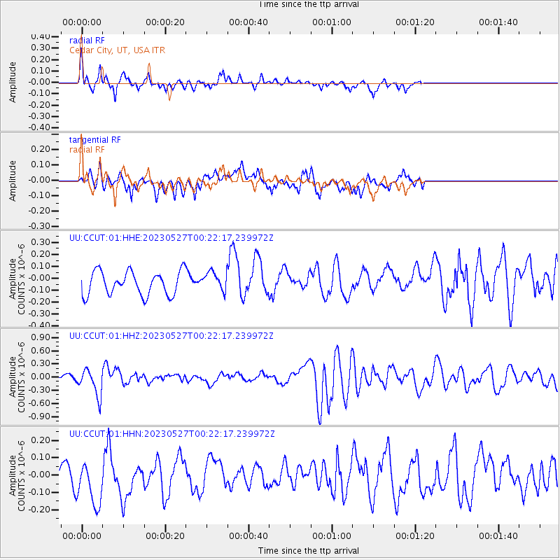
CCUT Cedar City, UT, USA - Earthquake Result Viewer
*The percent match for this event was below the threshold and hence no stack was calculated.
| Earthquake location: |
Tonga Islands |
| Earthquake latitude/longitude: |
-18.5/-175.2 |
| Earthquake time(UTC): |
2023/05/27 (147) 00:11:00 GMT |
| Earthquake Depth: |
215 km |
| Earthquake Magnitude: |
6.0 mww |
| Earthquake Catalog/Contributor: |
NEIC PDE/us |
|
| Network: |
UU University of Utah Regional Network |
| Station: |
CCUT Cedar City, UT, USA |
| Lat/Lon: |
37.55 N/113.36 W |
| Elevation: |
2127 m |
|
| Distance: |
80.5 deg |
| Az: |
45.27 deg |
| Baz: |
238.045 deg |
| Ray Param: |
$rayparam |
*The percent match for this event was below the threshold and hence was not used in the summary stack. |
|
| Radial Match: |
56.963253 % |
| Radial Bump: |
350 |
| Transverse Match: |
50.170437 % |
| Transverse Bump: |
400 |
| SOD ConfigId: |
30536071 |
| Insert Time: |
2023-06-10 00:41:57.921 +0000 |
| GWidth: |
2.5 |
| Max Bumps: |
400 |
| Tol: |
0.001 |
|
Signal To Noise
| Channel | StoN | STA | LTA |
| UU:CCUT:01:HHZ:20230527T00:22:17.239972Z | 6.424799 | 3.0973538E-7 | 4.820935E-8 |
| UU:CCUT:01:HHN:20230527T00:22:17.239972Z | 1.466931 | 1.4948606E-7 | 1.0190394E-7 |
| UU:CCUT:01:HHE:20230527T00:22:17.239972Z | 0.82502484 | 8.1107395E-8 | 9.830903E-8 |
| Arrivals |
| Ps | |
| PpPs | |
| PsPs/PpSs | |


