You are here: Home > Network List > G - GEOSCOPE Stations List
> Station MPG Montagne des Peres, French Guyana > Earthquake Result Viewer
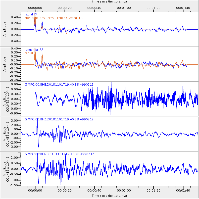
MPG Montagne des Peres, French Guyana - Earthquake Result Viewer
*The percent match for this event was below the threshold and hence no stack was calculated.
| Earthquake location: |
South Sandwich Islands Region |
| Earthquake latitude/longitude: |
-58.1/-25.2 |
| Earthquake time(UTC): |
2018/11/01 (305) 19:30:20 GMT |
| Earthquake Depth: |
29 km |
| Earthquake Magnitude: |
5.8 Mww |
| Earthquake Catalog/Contributor: |
NEIC PDE/us |
|
| Network: |
G GEOSCOPE |
| Station: |
MPG Montagne des Peres, French Guyana |
| Lat/Lon: |
5.11 N/52.64 W |
| Elevation: |
147 m |
|
| Distance: |
66.7 deg |
| Az: |
330.029 deg |
| Baz: |
164.544 deg |
| Ray Param: |
$rayparam |
*The percent match for this event was below the threshold and hence was not used in the summary stack. |
|
| Radial Match: |
75.59771 % |
| Radial Bump: |
400 |
| Transverse Match: |
54.681976 % |
| Transverse Bump: |
400 |
| SOD ConfigId: |
3131071 |
| Insert Time: |
2018-11-15 19:43:20.754 +0000 |
| GWidth: |
2.5 |
| Max Bumps: |
400 |
| Tol: |
0.001 |
|
Signal To Noise
| Channel | StoN | STA | LTA |
| G:MPG:00:BHZ:20181101T19:40:38.499021Z | 6.1353045 | 1.2694946E-6 | 2.0691633E-7 |
| G:MPG:00:BHN:20181101T19:40:38.499021Z | 3.7155588 | 5.088377E-7 | 1.3694782E-7 |
| G:MPG:00:BHE:20181101T19:40:38.499021Z | 1.6177533 | 2.9171676E-7 | 1.8032216E-7 |
| Arrivals |
| Ps | |
| PpPs | |
| PsPs/PpSs | |


