You are here: Home > Network List > WW - Idaho Seismic Network () Stations List
> Station BILL Emerald Creek, Idaho > Earthquake Result Viewer
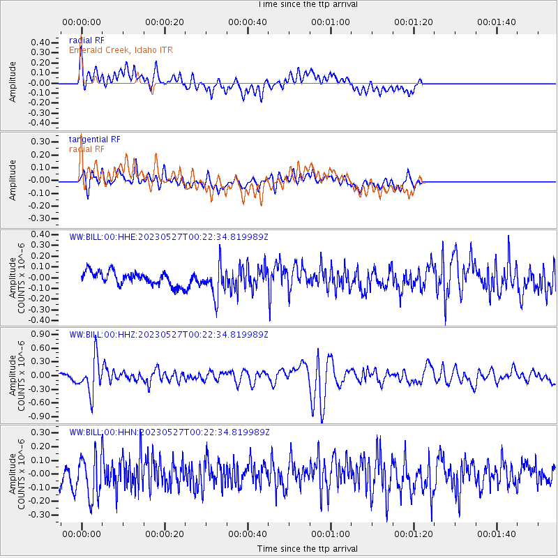
BILL Emerald Creek, Idaho - Earthquake Result Viewer
*The percent match for this event was below the threshold and hence no stack was calculated.
| Earthquake location: |
Tonga Islands |
| Earthquake latitude/longitude: |
-18.5/-175.2 |
| Earthquake time(UTC): |
2023/05/27 (147) 00:11:00 GMT |
| Earthquake Depth: |
215 km |
| Earthquake Magnitude: |
6.0 mww |
| Earthquake Catalog/Contributor: |
NEIC PDE/us |
|
| Network: |
WW Idaho Seismic Network () |
| Station: |
BILL Emerald Creek, Idaho |
| Lat/Lon: |
47.03 N/116.34 W |
| Elevation: |
866 m |
|
| Distance: |
83.9 deg |
| Az: |
36.072 deg |
| Baz: |
234.791 deg |
| Ray Param: |
$rayparam |
*The percent match for this event was below the threshold and hence was not used in the summary stack. |
|
| Radial Match: |
57.884876 % |
| Radial Bump: |
400 |
| Transverse Match: |
58.93727 % |
| Transverse Bump: |
400 |
| SOD ConfigId: |
30536071 |
| Insert Time: |
2023-06-10 00:46:01.267 +0000 |
| GWidth: |
2.5 |
| Max Bumps: |
400 |
| Tol: |
0.001 |
|
Signal To Noise
| Channel | StoN | STA | LTA |
| WW:BILL:00:HHZ:20230527T00:22:34.819989Z | 5.0878363 | 3.950776E-7 | 7.765139E-8 |
| WW:BILL:00:HHN:20230527T00:22:34.819989Z | 1.9223809 | 1.5867705E-7 | 8.2541945E-8 |
| WW:BILL:00:HHE:20230527T00:22:34.819989Z | 2.3208575 | 1.4446947E-7 | 6.224831E-8 |
| Arrivals |
| Ps | |
| PpPs | |
| PsPs/PpSs | |


