You are here: Home > Network List > US - United States National Seismic Network Stations List
> Station AMTX Amarillo, Texas, USA > Earthquake Result Viewer
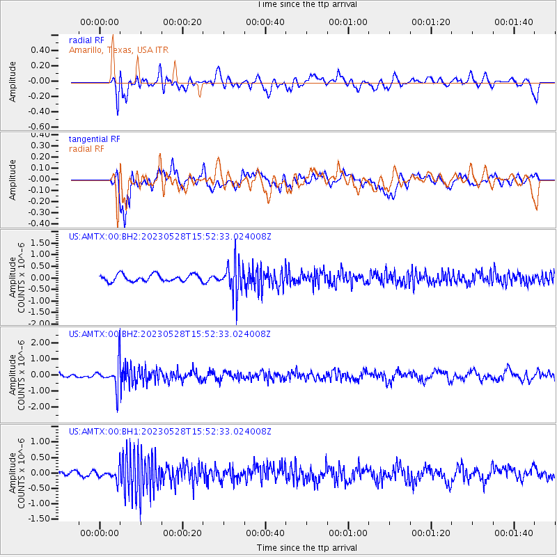
AMTX Amarillo, Texas, USA - Earthquake Result Viewer
*The percent match for this event was below the threshold and hence no stack was calculated.
| Earthquake location: |
Northern Colombia |
| Earthquake latitude/longitude: |
6.7/-73.0 |
| Earthquake time(UTC): |
2023/05/28 (148) 15:45:56 GMT |
| Earthquake Depth: |
158 km |
| Earthquake Magnitude: |
5.3 Mww |
| Earthquake Catalog/Contributor: |
NEIC PDE/us |
|
| Network: |
US United States National Seismic Network |
| Station: |
AMTX Amarillo, Texas, USA |
| Lat/Lon: |
34.53 N/101.41 W |
| Elevation: |
1010 m |
|
| Distance: |
38.1 deg |
| Az: |
320.485 deg |
| Baz: |
130.053 deg |
| Ray Param: |
$rayparam |
*The percent match for this event was below the threshold and hence was not used in the summary stack. |
|
| Radial Match: |
56.71191 % |
| Radial Bump: |
400 |
| Transverse Match: |
61.813675 % |
| Transverse Bump: |
400 |
| SOD ConfigId: |
30536071 |
| Insert Time: |
2023-06-11 16:15:41.136 +0000 |
| GWidth: |
2.5 |
| Max Bumps: |
400 |
| Tol: |
0.001 |
|
Signal To Noise
| Channel | StoN | STA | LTA |
| US:AMTX:00:BHZ:20230528T15:52:33.024008Z | 5.0489326 | 8.3035377E-7 | 1.6446126E-7 |
| US:AMTX:00:BH1:20230528T15:52:33.024008Z | 2.0897174 | 1.965688E-7 | 9.406479E-8 |
| US:AMTX:00:BH2:20230528T15:52:33.024008Z | 1.6601048 | 2.4037286E-7 | 1.447938E-7 |
| Arrivals |
| Ps | |
| PpPs | |
| PsPs/PpSs | |


