You are here: Home > Network List > US - United States National Seismic Network Stations List
> Station WUAZ Wupatki, Arizona, USA > Earthquake Result Viewer
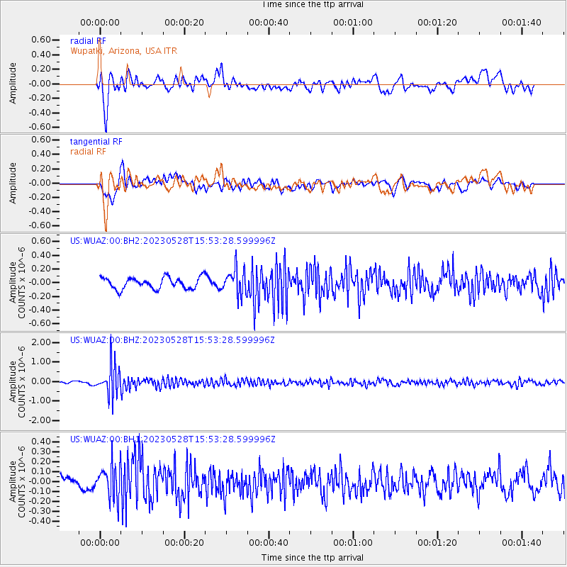
WUAZ Wupatki, Arizona, USA - Earthquake Result Viewer
*The percent match for this event was below the threshold and hence no stack was calculated.
| Earthquake location: |
Northern Colombia |
| Earthquake latitude/longitude: |
6.7/-73.0 |
| Earthquake time(UTC): |
2023/05/28 (148) 15:45:56 GMT |
| Earthquake Depth: |
158 km |
| Earthquake Magnitude: |
5.3 Mww |
| Earthquake Catalog/Contributor: |
NEIC PDE/us |
|
| Network: |
US United States National Seismic Network |
| Station: |
WUAZ Wupatki, Arizona, USA |
| Lat/Lon: |
35.52 N/111.37 W |
| Elevation: |
1592 m |
|
| Distance: |
45.4 deg |
| Az: |
314.647 deg |
| Baz: |
119.982 deg |
| Ray Param: |
$rayparam |
*The percent match for this event was below the threshold and hence was not used in the summary stack. |
|
| Radial Match: |
70.048096 % |
| Radial Bump: |
400 |
| Transverse Match: |
59.27309 % |
| Transverse Bump: |
400 |
| SOD ConfigId: |
30536071 |
| Insert Time: |
2023-06-11 16:16:44.902 +0000 |
| GWidth: |
2.5 |
| Max Bumps: |
400 |
| Tol: |
0.001 |
|
Signal To Noise
| Channel | StoN | STA | LTA |
| US:WUAZ:00:BHZ:20230528T15:53:28.599996Z | 6.7851796 | 7.850575E-7 | 1.157018E-7 |
| US:WUAZ:00:BH1:20230528T15:53:28.599996Z | 1.9555379 | 1.7211033E-7 | 8.801177E-8 |
| US:WUAZ:00:BH2:20230528T15:53:28.599996Z | 2.2598186 | 1.8593742E-7 | 8.2279804E-8 |
| Arrivals |
| Ps | |
| PpPs | |
| PsPs/PpSs | |


