You are here: Home > Network List > UW - Pacific Northwest Regional Seismic Network Stations List
> Station UMAT Pilot Rock, OR, USA > Earthquake Result Viewer
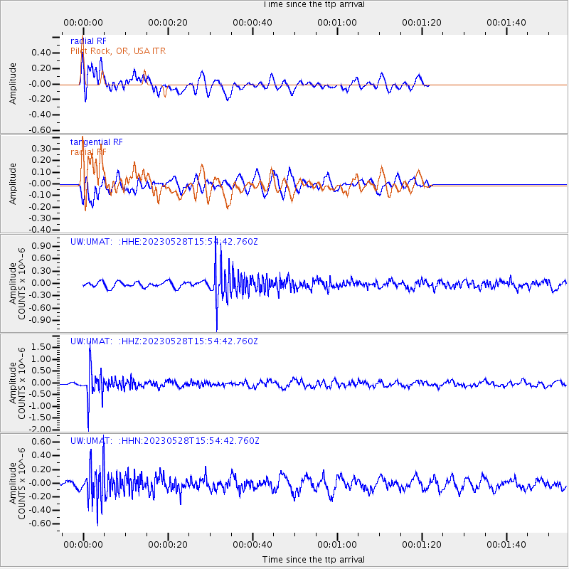
UMAT Pilot Rock, OR, USA - Earthquake Result Viewer
*The percent match for this event was below the threshold and hence no stack was calculated.
| Earthquake location: |
Northern Colombia |
| Earthquake latitude/longitude: |
6.7/-73.0 |
| Earthquake time(UTC): |
2023/05/28 (148) 15:45:56 GMT |
| Earthquake Depth: |
158 km |
| Earthquake Magnitude: |
5.3 Mww |
| Earthquake Catalog/Contributor: |
NEIC PDE/us |
|
| Network: |
UW Pacific Northwest Regional Seismic Network |
| Station: |
UMAT Pilot Rock, OR, USA |
| Lat/Lon: |
45.29 N/118.96 W |
| Elevation: |
1318 m |
|
| Distance: |
55.3 deg |
| Az: |
321.877 deg |
| Baz: |
119.7 deg |
| Ray Param: |
$rayparam |
*The percent match for this event was below the threshold and hence was not used in the summary stack. |
|
| Radial Match: |
62.85681 % |
| Radial Bump: |
400 |
| Transverse Match: |
46.03315 % |
| Transverse Bump: |
365 |
| SOD ConfigId: |
30536071 |
| Insert Time: |
2023-06-11 16:19:49.921 +0000 |
| GWidth: |
2.5 |
| Max Bumps: |
400 |
| Tol: |
0.001 |
|
Signal To Noise
| Channel | StoN | STA | LTA |
| UW:UMAT: :HHZ:20230528T15:54:42.760Z | 8.274022 | 6.00933E-7 | 7.2628886E-8 |
| UW:UMAT: :HHN:20230528T15:54:42.760Z | 5.08656 | 2.5328123E-7 | 4.9794213E-8 |
| UW:UMAT: :HHE:20230528T15:54:42.760Z | 6.0065103 | 4.108547E-7 | 6.840157E-8 |
| Arrivals |
| Ps | |
| PpPs | |
| PsPs/PpSs | |


