You are here: Home > Network List > TA - USArray Transportable Network (new EarthScope stations) Stations List
> Station 239A Gary, TX, USA > Earthquake Result Viewer
239A Gary, TX, USA - Earthquake Result Viewer

| Earthquake location: |
Near Coast Of Northern Chile |
| Earthquake latitude/longitude: |
-28.0/-70.8 |
| Earthquake time(UTC): |
2010/03/26 (085) 14:52:07 GMT |
| Earthquake Depth: |
42 km |
| Earthquake Magnitude: |
6.2 MB, 5.9 MS, 6.3 MW, 6.1 MW |
| Earthquake Catalog/Contributor: |
WHDF/NEIC |
|
| Network: |
TA USArray Transportable Network (new EarthScope stations) |
| Station: |
239A Gary, TX, USA |
| Lat/Lon: |
32.02 N/94.47 W |
| Elevation: |
100 m |
|
| Distance: |
63.7 deg |
| Az: |
337.669 deg |
| Baz: |
156.692 deg |
| Ray Param: |
0.059293363 |
| Estimated Moho Depth: |
10.25 km |
| Estimated Crust Vp/Vs: |
1.94 |
| Assumed Crust Vp: |
6.245 km/s |
| Estimated Crust Vs: |
3.219 km/s |
| Estimated Crust Poisson's Ratio: |
0.32 |
|
| Radial Match: |
88.093735 % |
| Radial Bump: |
319 |
| Transverse Match: |
60.939392 % |
| Transverse Bump: |
394 |
| SOD ConfigId: |
312771 |
| Insert Time: |
2010-06-28 16:53:39.075 +0000 |
| GWidth: |
2.5 |
| Max Bumps: |
400 |
| Tol: |
0.001 |
|
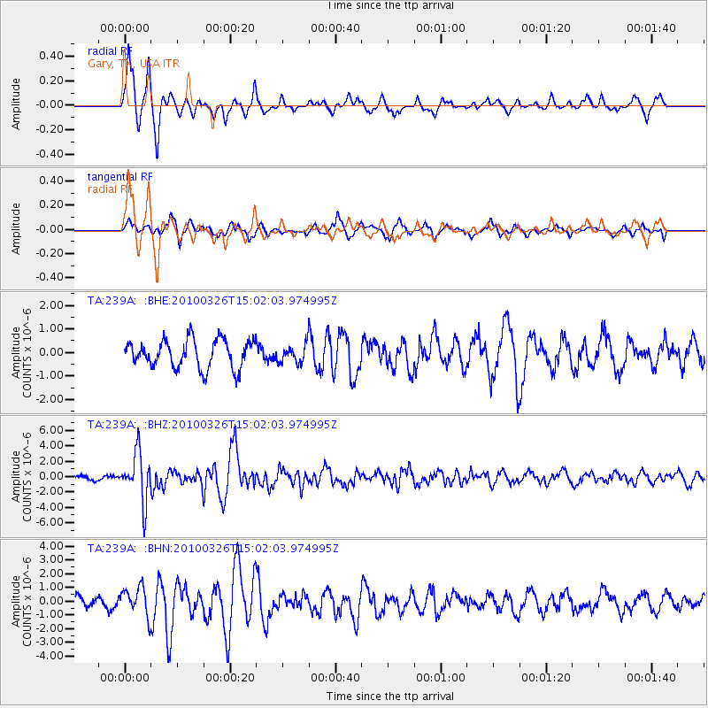
Signal To Noise
| Channel | StoN | STA | LTA |
| TA:239A: :BHZ:20100326T15:02:03.974995Z | 9.84332 | 3.1603388E-6 | 3.2106433E-7 |
| TA:239A: :BHN:20100326T15:02:03.974995Z | 2.8206568 | 1.0684033E-6 | 3.7877822E-7 |
| TA:239A: :BHE:20100326T15:02:03.974995Z | 0.655453 | 3.9033628E-7 | 5.955214E-7 |
| Arrivals |
| Ps | 1.6 SECOND |
| PpPs | 4.7 SECOND |
| PsPs/PpSs | 6.3 SECOND |


