You are here: Home > Network List > US - United States National Seismic Network Stations List
> Station MSO Missoula, Montana, USA > Earthquake Result Viewer
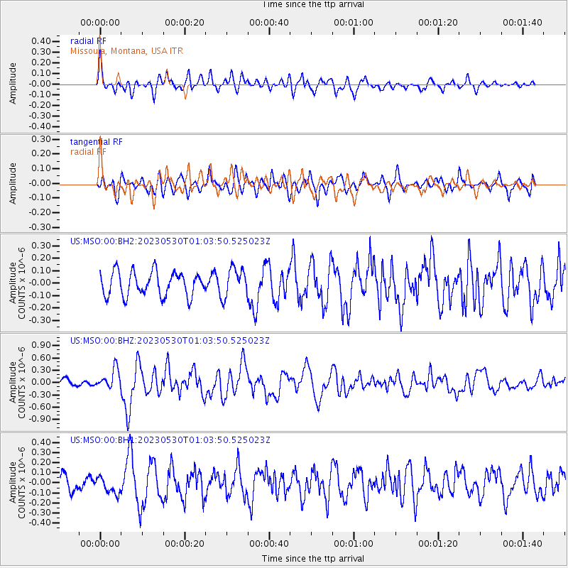
MSO Missoula, Montana, USA - Earthquake Result Viewer
*The percent match for this event was below the threshold and hence no stack was calculated.
| Earthquake location: |
Volcano Islands, Japan Region |
| Earthquake latitude/longitude: |
24.1/143.0 |
| Earthquake time(UTC): |
2023/05/30 (150) 00:52:06 GMT |
| Earthquake Depth: |
10 km |
| Earthquake Magnitude: |
5.8 Mww |
| Earthquake Catalog/Contributor: |
NEIC PDE/us |
|
| Network: |
US United States National Seismic Network |
| Station: |
MSO Missoula, Montana, USA |
| Lat/Lon: |
46.83 N/113.94 W |
| Elevation: |
1264 m |
|
| Distance: |
81.2 deg |
| Az: |
42.604 deg |
| Baz: |
295.681 deg |
| Ray Param: |
$rayparam |
*The percent match for this event was below the threshold and hence was not used in the summary stack. |
|
| Radial Match: |
54.58965 % |
| Radial Bump: |
400 |
| Transverse Match: |
62.41236 % |
| Transverse Bump: |
400 |
| SOD ConfigId: |
30536071 |
| Insert Time: |
2023-06-13 01:21:22.171 +0000 |
| GWidth: |
2.5 |
| Max Bumps: |
400 |
| Tol: |
0.001 |
|
Signal To Noise
| Channel | StoN | STA | LTA |
| US:MSO:00:BHZ:20230530T01:03:50.525023Z | 2.4225435 | 2.494402E-7 | 1.02966254E-7 |
| US:MSO:00:BH1:20230530T01:03:50.525023Z | 0.80024767 | 8.04362E-8 | 1.00514136E-7 |
| US:MSO:00:BH2:20230530T01:03:50.525023Z | 1.2075611 | 1.1646369E-7 | 9.6445376E-8 |
| Arrivals |
| Ps | |
| PpPs | |
| PsPs/PpSs | |


